To be read alongside the Archived LeJog pages to the left!
Thursday 18th April
Finishing Section 6!
Taking a few days off from updating this to write the book version of Section 6 - Back Soon!
Taking a few days off from updating this to write the book version of Section 6 - Back Soon!
Day 65 doggerel!

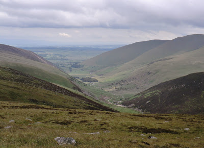
Bellingham & the North Tyne valley
In the early days of railway this was mooted as a possible route for a main Anglo-Scottish line
The single-track railway that was actually built meandered its way up to the Border through land now swallowed by Kielder Forest & was closed to passengers in 1956
My second visit &, unlike last time, few of the visitors seemed to be Pennine Way walkers

The wild emptiness of Hareshaw Common
The terrain was to be much like this all the way to Kielder Forest - thank goodness for the weather!
 And until the 1920s this terrain was very similar; now it's the largest man-made woodland in Britain
I was quite pleased, after the first mile or so of the 'Forest' to be following one of the main access roads & through young trees
I hadn't really expected any views but all of this was impressive.... if a little hard on the feet!

Last pub stop in England
'The Redesdale Arms' is a couple of miles south-east of our final overnight stop before Scotland.... hence its alternative name!
The oldest part of the pub is over 600 years old & was once a fortified house, surviving several skirmishes with Border Reivers!

Last pub stop in England
'The Redesdale Arms' is a couple of miles south-east of our final overnight stop before Scotland.... hence its alternative name!
The oldest part of the pub is over 600 years old & was once a fortified house, surviving several skirmishes with Border Reivers!

While I tackled the forest The Manager was sight-seeing at Kielder Water
Planned in the late 1960s to provide water to booming Northern industries, it was a little redundant by the time it was fully operational in the 1980s!
Leisure & hydro-electricity are now the order of the day
Wednesday 17th April
Back on The Pennine Way 'proper'!
Day 64 dodos!
 'Proper' because the two National Trails share the same route between Thirlwall Castle & this innocuous-looking gate beside Turret 37A - now I was on my own.... but at least I was heading due north again!
Outcrop below Cuddy's Crags & already I was drifting off to the left to avoid the boggier patches.... so much for following The Pennine Way!

Broomlee Lough & Sewingshields Crag
Now, whether the Arthur I'd read about who is sleeping here is the same one that I'd bumped into a couple of months ago at the other end of the country, I'm not sure....
...but, as you might imagine, there are legends to support it!
One story tells of Arthur bestowing valuable gifts (or a golden goblet, according to the source!) upon Comyn, a renowned Northern chieftain
Comyn was pursued by some of Arthur's minions (or his sons, dependent upon source!) who disapproved of the King's generosity
Comyn was murdered & the treasure, somehow, finished at the bottom of Broomlee Lough!
Another legend tells of an occupant of Sewingshields Castle who, forced to leave but unable to carry his gold, decided to sink the treasure in Broomlee Lough. He put a spell on it that it should never be recovered except by "Twa twin yauds (horses), twa twin oxen, twa twin lads, and a chain forged by a smith of kind." Comyn was pursued by some of Arthur's minions (or his sons, dependent upon source!) who disapproved of the King's generosity
Comyn was murdered & the treasure, somehow, finished at the bottom of Broomlee Lough!

No treasure here but this was used by the Romans as a reservoir - traces of an aqueduct meandering around the contours can be seen to the west, heading towards the site of Great Chesters Fort
Back to Arthur & Guinevere!
These are King's Crags & Queen Crags, just north of Sewingshields, or 'Seven Shields Castle'

Legend has it that during a tiff Arthur hurled a twenty ton boulder at Guinevere across this quarter mile gap; brushing her hair at the time, the good lady deflected said boulder with her comb & it still bears the tooth-marks!
Now, even I find that hard to believe....

Some 3 hours between these photos as I took on boggy moorland, dense plantations & a fascinating collection of insects.... & I was still an hour from Bellingham!
This is Shitlington Hall (Farm!) below Ealinghamrigg Common
Tuesday 16th April
Vindolanda - Lazy Day!
Day 63 diversionaries!

Water-channels, drains, sewers, bath-houses are amongst the best preserved of all the remains.... or is it that they are just the easiest to identify?
Interesting that the Romans actually had a problem with running water at Vindolanda - there isn't a readily available source on the site

The Roman army built its first fort here around 85 AD & when the Wall was completed, about 40 years later, the garrison moved on to Housesteads being replaced at Vindolanda by another regiment
Vindolanda was under constant military occupation until the end of Roman rule in Britain, early in the 5th century.... & then for another 200 years or so as 'government' forces tried to repel Northern invaders

Replicas of altars from the Commanding Officer's Residence & a tombstone - one of my only complaints was that some of the most interesting pieces are confined in other museums, hundreds of miles away!

Reconstructed Roman Temple.... don't suppose I could have expected the genuine article in this case!

Reconstructed Roman Temple.... don't suppose I could have expected the genuine article in this case!

Interior of the Temple

Back to the job in hand & the shortest day's walk of the whole LeJog!
Started in earnest at Steel Rigg

What on earth they were all doing here is anybody's guess.... maybe seeking directions!

Crag Lough & the start of tomorrow's splashy route north after rejoining The Pennine Way

Crag Lough & Hotbank Farm & Crags, beyond which Housesteads Fort lies nestled beneath the summit, to the right
Monday 15th April
Hadrian's Wall at last!
Day 62 disparates!
View north from the ridge where Hadrian's Wall once stood - still a little elusive!

This is taken from a point between the fashion outlet of Haytongate & my first glimpse of the Wall 'proper' at Hare Hill

The wall at Willowford where a magnificent stone bridge, guarded by turrets, spanned the River Irthing just before Birdoswald Roman fort
The Romans actually built three different bridges here as the river changed its course during their occupation
After the Roman bridge fell into disuse no further crossing was built until 1999, a footbridge for National Trail walkers!

Built in the 12th century & fortified by the Thirlwall family in the 14th with material from Hadrian's Wall
Its name means 'Gap-in-the-Wall' but there probably wasn't one until they pinched the stones!

Built in the 12th century & fortified by the Thirlwall family in the 14th with material from Hadrian's Wall
Its name means 'Gap-in-the-Wall' but there probably wasn't one until they pinched the stones!
This was a wild place to live in the days when Carlisle Castle was regularly changing hands
My favourite story tells of how, during one Border raid, a servant took the Thirlwalls' most prized possession, a gold table & hid it down the well
Local legend has it that he & the table are still there, protected by a magic spell!

Almost a complete reverse of the photo on the original blog - this is Walltown Crags taken from the quarry!

No doubt that we were walking beside the real Hadrian's Wall now
Spectacular stuff!

The Manager was absolutely flying along this stretch - easy to see she hadn't been doing too much walking for a few days!
The turret on Walltown Crags is quite unusual in that it was built as a free-standing look-out tower before the wall existed
Consequently it is not built into the wall, the wall simply abuts it, & that also accounts for the fact that it is rather less than the usual 1/3 mile from the next turret

Wonderful roller-coaster walking as the wall follows escarpments & undulations of the Whin Sill.... those Romans knew what they were doing when they chose this as their defensive line!

Cawfields Quarry
No archaeological sentimentality here as 20th century road-builders systematically destroyed the Whin Sill.... and Hadrian's Wall!
Closed in 1944, the area is now cluttered with an embarrassment of conservation signs & notices!

Once Brewed? Twice Brewed? Depends from which direction you approach the village, east or west!
The pub is excellent regardless of approach, though I've mostly arrived from the north, Steel Rigg, on the Wall
The internet has fanciful stories about Youth Hostels but that has to be a bit far-fetched.... doesn't it?
Saturday 13th April
Day 61 dinosaurs!

Construction of Carlisle Castle began in 1093, on the site of an old Roman fort, after William II had driven the Scots from Cumberland
Never a people to take things laying down, the castle was to change hands several times before the unification in 1603
Even then the Scots were to make one final (so far!) attempt during the 1745 Jacobite Rising. Since the defeat of Bonnie Prince Charlie & the execution of his supporters it's all been a bit quiet up here!
A lovely city, obviously proud of its heritage

Wandered towards the cathedral & passed through several subways, such as this one, celebrating the area's industrial past

Hadrian's Wall, which I would be following for the next few days, also gets in on the act with this huge & fascinating pavement replication

Hadrian's Wall, which I would be following for the next few days, also gets in on the act with this huge & fascinating pavement replication

Local artist, Hannah Stewart, was responsible for a series of nine of these superb granite benches in Castle Street
"The line of Hadrian’s Wall has been used, as well as the River Eden and the railways – capturing Carlisle’s unique history and border location as well as its landscape"
This project was finally completed on May 11th, just six weeks before our visit!

The Fratry, Carlisle Cathedral
This was the dining hall for the monks of the medieval Priory
Inside the Cathedral
(one of Britain's smallest & the second smallest in England, after Oxford))

Amazingly difficult to pin down definite details despite the wealth of guidebooks on sale & the number of information boards scattered around outside
I wouldn't be much of a Walker if I wasn't able to identify this as the West Window, I always carry a compass with me.... I'm not sure that GPS would have helped!
I have it on good authority that the font is Norman
 Founded in 1122 & built by the first Bishop of Carlisle, Aethelwulf, it occupies the site of an 8th century church destroyed by Vikings
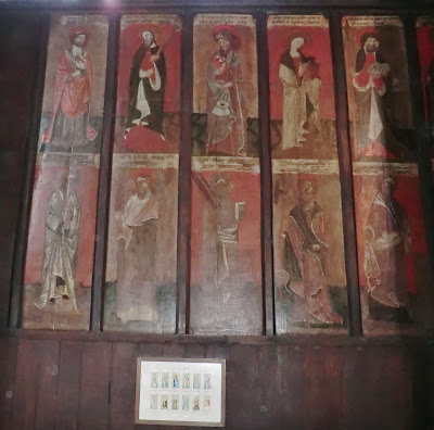
These medieval paintings depict the twelve Apostles & stand alongside similar images of St. Cuthbert, St. Augustine & St. Antony
Inside the Cathedral
(one of Britain's smallest & the second smallest in England, after Oxford))

Amazingly difficult to pin down definite details despite the wealth of guidebooks on sale & the number of information boards scattered around outside
I wouldn't be much of a Walker if I wasn't able to identify this as the West Window, I always carry a compass with me.... I'm not sure that GPS would have helped!
I have it on good authority that the font is Norman
 Founded in 1122 & built by the first Bishop of Carlisle, Aethelwulf, it occupies the site of an 8th century church destroyed by Vikings
These medieval paintings depict the twelve Apostles & stand alongside similar images of St. Cuthbert, St. Augustine & St. Antony

"Who will rid me of this meddlesome priest?"
Not a sensible thing to say about one of your mates, even in jest.... & especially when you're the King!
This isn't one of the swords used to kill Thomas Becket though one of the originals was entrusted to the safe-keeping of the Cathedral (what happened to that?!)
More intriguing to me is that this is where Robert the Bruce swore his allegiance to Edward I in 1297 who, incidentally & along with many others, craved the sword. Cross, cross & double-cross: Edward ultimately defeated the Bruce & forced him into exile but then came Bannockburn &, with Edward long gone, the rest, as they say, is history.... !


The medieval ceilings, restored in the 19th century, are particularly impressive & though the blue 'starry sky' receives all the accolades I love the wood & painted bosses at the entrance to the choir

A comparatively recent addition to the Cathedral's 'furniture'!
Believed to have been carved in 1559 & originally standing in St.Andrews, Antwerp, the pulpit 'escaped' to Bedfordshire during the Napoleonic Wars
It was brought to Carlisle in memory of Dean Cyril Mayne who died in 1962
Loads more photos of the Cathedral but they'll have to wait for the book!
Interesting footnote: Sir Walter Scott, who was to feature heavily in later LeJog days, was married here on Christmas Eve, 1797, to Charlotte Carpenter when he was still just plain old Walter.... & I didn't know that before!
Friday 12th April
Day 60 dilettantes!

Started the day with an exploration of Caldbeck & a wander around Les' highlights from her 'Garden Trail' of yesterday

This was one of her favourites

Naturally, my number one target was Howk Bobbin Mill & another industrial site I hadn't had time to explore on 'The Cumbria Way' - a timetable to walk to & too many buses to catch!

Just a tiny part of the world-wide cotton manufacturing industry
Whilst also making axe & brush handles, clog soles, mole traps & washing dollies (I remember my Mum having one of those!), its main product was spinning & threading bobbins - hence its name
Operational between 1857 & 1924, when it opened it was driven by the country's second-biggest water-wheel
At its peak it provided employment for up to 60 workers from Caldbeck village, a five-minute walk away

Cald Beck, which powered the Mill as it raced through the quarried limestone gorge, & another of Les' gardens!

Off to the churchyard now & another bit of Industrial Heritage
'The Roughton Stone' is a memorial to the mining families who worked in Roughton Gill, Caldbeck for over 400 years
A more famous memorial is to a man unlikely to have ever seen the inside of a mine.... or a Bobbin Mill!
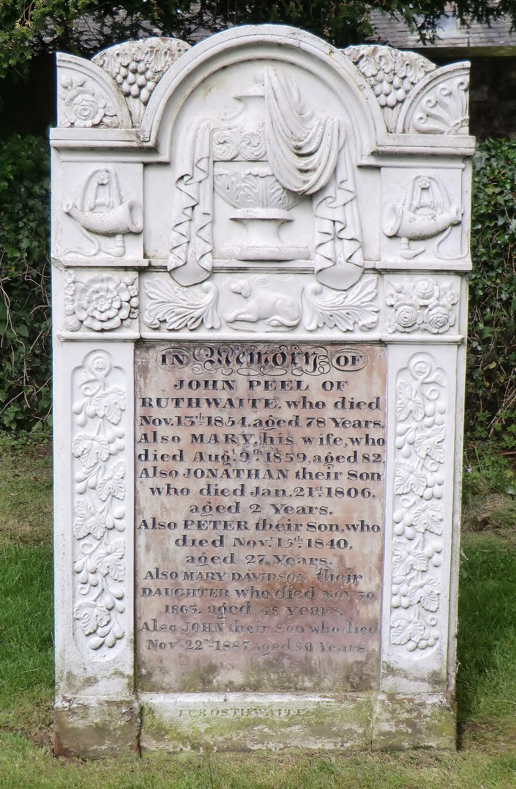
D'ye ken John Peel with his coat so gay?Chorus
- For the sound of his horn brought me from my bed,
- And the cry of his hounds which he oftime led,
- Peel's "View, Halloo!" could awaken the dead,
- Or the fox from his lair in the morning
A farmer by profession, John Peel was heavily in debt by the time of his death & his sons were forced to seek employment as servants in the homes of men alongside whom he used to hunt
His memorial was vandalized by anti-hunt campaigners in 1977

St. Kentigern's Church, or St. Mungo's (was that his nickname?!) is particularly famous for its stained glass

St. Kentigern's Church, or St. Mungo's (was that his nickname?!) is particularly famous for its stained glass

The oldest part of St. Kentigern's was built in 1112 on the site of an earlier, 6th century, church
These windows depict St. Kentigern & St. Cuthbert - I was to bump into him several times later on LeJog!

Priest's Mill,
Caldbeck
Built by a rector at St. Kentigern's, this operated as a corn-mill from 1702 until 1933 & then continued as a sawmill & workshop until floods destroyed the dam in 1965
Now houses a popular café/restaurant.... which I have yet to pass when open!


St. Mary's Church, Sebergham
Close to the setting of the early 19th century ballad, 'Lord Baldwin', which tells the story of an evil nobleman tormented by the ghosts of two women whom he has betrayed & murdered!

Rose Bridge, Rose Castle, River Caldew

Expensive Independent School near Dalston specialising in the education of dyslexic students

Bumped into the 'Discover Eden' Walk & Project shortly after being forced on to the eastern bank of the Caldew shortly after Bridge End
A new path to me &, having become soon lost in the undergrowth, a new path to many others, I suspect!

Enormous weir on the Caldew at Denton Holme, just before Carlisle proper!
Constructed to power the Ferguson Mills in the background which closed in the 1990s
The Ferguson Brothers were another link in the cotton manufacturing trade; they were also 'bleachers, dyers & textile printers'

'The Boardroom', close to the cathedral in Carlisle (tomorrow's exploration!)
A pub since its construction in 1651.... so one of the older drinking establishments visited on LeJog
Thursday 11th April
"Caldbeck fells are worth all England else"
Day 59 differentials!

 Samuel Ladyman provided four or five fountains and some 20 seats in and around Keswick, choosing sites for their views of the countryside.
Amongst others there were seats at Grange Bridge, the Bowder Stone, Catbell, Honister, the old bowling green behind the Oddfellows Arms, and a large double seat on Castlehead.
Apart from this one he also built fountains on Latrigg and Castlerigg toll-bar.
Other philanthropic ventures saw him raising funds to provide bread & soup for the poor during the area's harsh winters

A view of the Derwent as it disappears around Dodd Wood to Bassenthwaite Lake
I'd paused for breath having just raced away from hordes of walkers setting out to climb Latrigg &, presumably later, to tackle Skiddaw

The point at which I left those making the Skiddaw pilgrimage
Howgill Tongue to the left, my route around Lonscale Fell to the right & the watery Whit Beck forging up the hill between them
Back on Bernie's Industrial Heritage Trail & a mine I'd photographed but left unresearched when I passed on 'The Cumbria Way' in 2007
Astonishingly the buildings had been finally abandoned less than 20 years before this, in 1988!

This is Carrock Wolfram Mine, on Grainsgill Beck, just below Carrock Fell - the only site in Britain outside Devon & Cornwall where wolfram can be found
Sunk as a lead mine in 1854 the wolfram was discarded as an irritating waste-product for the best part of 150 years until, at the beginning of the 20th century, it was used in the production of tungsten. Tungsten is one of the hardest metals & has the highest melting-point of all which, with the development of the electric light bulb & the arms race on to build tungsten steel armour-plated battleships, sent the world price of wolfram through the roof.
Unfortunately, during a time of economic difficulty, the Carrock Mine had been sold to a German company & the wolfram was being exported to Europe!
With World War I looming the Mining Company was liquidised &, with Government support, Carrock contributed to the manufacture of British ships & armour-piercing shells!
A post-war slump led to the mine's closure & it was only World War II & the Korean War in the 1950s that kept any interest alive, though the mine remained unworked until 1977 when the use of tungsten in Cathode Ray Tubes again sent prices soaring
Closed again in 1981, Carrock was kept on a care & maintenance basis waiting for the next 'boom'!The owners' lease finally expired in 1988 & most of the larger buildings subsequently demolished
How could I miss that story the first time around??!!

Looking in the opposite direction, these are the Uldale Fells, some 500' lower than my immediate target - High Pike.
Sunk as a lead mine in 1854 the wolfram was discarded as an irritating waste-product for the best part of 150 years until, at the beginning of the 20th century, it was used in the production of tungsten. Tungsten is one of the hardest metals & has the highest melting-point of all which, with the development of the electric light bulb & the arms race on to build tungsten steel armour-plated battleships, sent the world price of wolfram through the roof.
Unfortunately, during a time of economic difficulty, the Carrock Mine had been sold to a German company & the wolfram was being exported to Europe!
With World War I looming the Mining Company was liquidised &, with Government support, Carrock contributed to the manufacture of British ships & armour-piercing shells!
A post-war slump led to the mine's closure & it was only World War II & the Korean War in the 1950s that kept any interest alive, though the mine remained unworked until 1977 when the use of tungsten in Cathode Ray Tubes again sent prices soaring
Closed again in 1981, Carrock was kept on a care & maintenance basis waiting for the next 'boom'!The owners' lease finally expired in 1988 & most of the larger buildings subsequently demolished
How could I miss that story the first time around??!!

And here is Carrock Fell, taken from below Skiddaw House before I struggled through the mud & bog of the Caldew valley to reach Grainsgill

Looking east down the Caldew valley, not the approach I made (!), from Great Lingy Hill.
This is the route to war that all that wolfram took; the mining scars can still be clearly seen on the valley floor

Looking in the opposite direction, these are the Uldale Fells, some 500' lower than my immediate target - High Pike.
Did all that cloud suddenly transfer itself from Skiddaw?!
Wednesday 10th April
A Watery Walk to Keswick
Day 58 deserters!
 A last look back to Bull Crag & yesterday's route down Langstrath & Borrowdale.... Hmmm, are those clouds coming or going?
Grange Village backed by King's How & Grange Fell

Carries up to 93 passengers around the various stopping-off places of Derwentwater
Had the weather been kinder & visibility better I'd intended to walk Lee & Marion up Black Crag & over Cat Bells en route to Keswick but with the clouds sinking still further we opted for the much gentler stroll through Brandelhow Park
Good thing we did or we'd have missed these additional sculptures celebrating 100 years of The National Trust
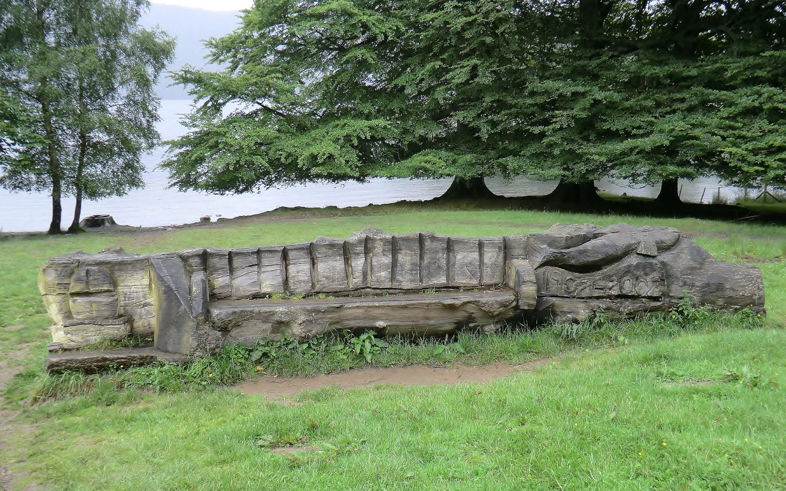
The bench is carved from a single tree-trunk & has the Trust's acorn symbol at one end & the centenary dates at the other - Brandelhow Park, the Trust's first purchase, is predominantly oak


The Trust was founded in 1896 & its first lifelong member was Beatrix Potter's father, Rupert, a wealthy London lawyer who took his family to Windermere for a summer holiday in 1887 & did more than he imagined for the future of the area's tourist industry!
Brandelhow was opened to the public in October 1902, by Princess Louise, daughter of Queen Victoria
Tuesday 9th April
Day 57 delinquents!
Thought that after an 18 month 'rest' for new knees & to write-up the first 5 volumes of LeJog as books that I ought to finish this off.... just in case anyone's waiting for the rest of the photos!
 Last of the 'family' walking weekends - we were to be on our own after this! Amazed, though, at how they managed to 'drop-in' for the very best bits!
Lee & house-mate, Marion, setting out for the head of Langdale.

Great Langdale, if you wish to be absolutely accurate; Little Langdale runs almost parallel, just over the fells to the south
This is Langdale Beck & a view of one path out of the valley, up Rossett Gill to Angle Tarn. Not our route today but we'd come this way with Lee in 2005 when we were walking 'The Ravenber'. (Ravenglass to Berwick-on-Tweed)

Easy to follow this waterfall up to Stake Pass.
To the right, the scree slopes of Stickle Pike provided Neolithic Man with the raw materials he needed to make stone axe heads & those who lived here must have been very entrepreneurial or just well-travelled as examples of Langdale stone have been found at various sites throughout the British Isles!

Bit gloomy & rain threatening as we made our way through Stake Pass to Langstrath
Met the biggest Duke of Edinburgh group I've ever encountered: all female & obviously beginners as they had a guide with them. Most of them were having a great time but some desperately needed a downhill stretch!
 Upper Langstrath Valley
Again, not on today's agenda but a good route to Esk Hause & Scafell Pike from Borrowdale
Note that this is a Valley & not a Dale!

Langstrath Beck

This character had a bit of a 'They Shall Not Pass' mentality but fortunately she was soon seduced by an attractive patch of grass & we were able to continue safely

Lower Langstrath, just before it turns into Borrowdale proper
The two valleys were at the centre of an acrimonious land dispute in the 13th century: Langstrath belonging to Fountains Abbey, the rest of Borrowdale to Furness Abbey - both were desperate to control ALL of this rich pastureland
Tired of the unbefitting arguments, Edward I confiscated the whole of the Dale whereupon the monks of Fountains double-crossed their neighbours by purchasing the said land from the Crown for 40 shillings!
What neither Abbey failed to appreciate at the time was that beneath this pasture lay an extraordinarily pure deposit of solid graphite - the only one ever found
Thus Keswick became the world's first manufacturer of graphite pencils, they continued until 2008, while local farmers preferred to use the mineral to mark their sheep!

Bull Crag,
Stonethwaite

Finished the day here at 'The Scafell Hotel', Rosthwaite, as we have on several other occasions....!
Tuesday 18th October
Day 56 dead-heads!

Not sure how I managed to select only 6 pictures for the original blog!
Started today's stretch walking along the lakeside from our conveniently-situated campsite
Not sure whether this is a sculpture, a shelter or a bandstand - I've seen it described as all three!

Looking north along the lake from Bowness-on-Windermere

... or don't feed them at all! The promenade was awash with blessed swans & happily-snapping tourists
Hardly room for the humble walker!

Today's target standing impressively on the horizon
Langdale Pikes viewed across Windermere from near the National Park Centre at Brockhole

... & a closer view from the lakeside at Wansfell Holme

High Wray & Latterbarrow from Wansfell Holme, close to the head of the Lake

Just about managed to capture the old pier building at Waterhead between the regimented lines of Junior School children being marched backwards & forwards.... Health & Safety, I guess, so close to all that water!
In 1845 the Windermere Steam Yacht Company launched their first paddle-steamer, the 'Lady of the Lake', & this operated from the newly-opened pier
The railway arrived 2 years later & the rest, as they say, is tourist history!

'Queen of the Lake' & 'Princess of the Lake' at Waterhead.... waiting for passengers!

First pub stop of the day was here at the 'Wateredge Inn' - very quiet as most of the visitors, unlike at Bowness, were school-children

Above: view across the northern end of the Lake from the pub garden to Loughrigg Fell
Right: brown-headed gull that sailed serenely past me... expecting breakfast?

Ambleside Pier

'The Talbot' is more of a walkers' bar to the rear of the Skelwith Hotel - stopped here on several Langdale walks in the past
 Built as a farmhouse in the 17th century, the hotel has also served its time as a corn mill & a brewery!
The short, sharp shower proved to be the only damp spot of the day, so this was time well-spent!

Coelacanth spotted in the stonemason's yard at Skelwith Bridge
I'm sure I remember lots more artistic bits & pieces here on previous visits

Another old favourite!
Lunch-time now but Elterwater was not particularly busy.... there have been times when I've had to sit on the grass under the tree, just about the point from which this picture was taken


Over 400 years old, 'The Britannia', no doubt, was well-used by quarrymen & workers in Elterwater's old gunpowder mill
Well, reached here finally & in glorious sunshine!
From the left: Pike O'Stickle, Harrison Stickle & Pavey Ark.... with Dungeon Ghyll & its bar beckoning!

Today's walk wasn't really a pub crawl, though I did visit more pubs on this stretch than any other on the whole LeJog! Only one pint in each.... & how could I have missed any of them out?
Finished at the most famous, which still worked as both a farm & an inn until as recently as1949
Originally 'Middlefell Inn', the business was run by owner John Bennett who doubled as an early-Victorian tourist guide
Bought by a Professor Trevelyan early last century, he immediately gave it to the National Trust &, thus, it became their first Langdale property
The hotel achieved fame through its 'Climbers Bar', used by Climbing Clubs from across the country & frequented by some of Britain's most famous mountaineers
Sunday 16th October
Day 55 Dark Stars!

First stretch of today's walk took me upstream beside the River Kent from Burneside to Staveley via the tiny old mill village of Bowston
James Cropper's paper industry has dominated the area since 1845 & they are still based in Burneside but many of the older buildings are now residential & much of their land has been sold for housing
Spotted this Victoria Regina postbox tucked away in Bowston village

Smartest of the 'mill conversions' is at Cowan Head
Originally built as a fulling mill, it was converted to a paper mill by local publisher, Thomas Ashburner, who also founded one of Cumbria's earliest newspapers, 'The Kendal Weekly Mercury'
James Cropper first rented the buildings before buying them outright in 1854 &, in 1879, he built a narrow gauge railway linking his 3 Kentside mills
In 1927 this was upgraded to standard gauge using rails captured from the Turks during World War I & linked to the main Windermere line!

A slightly over-enthusiastic River Kent!
The recent heavy rain made this stretch beyond Cowan Head quite hazardous
My slightly waterlogged route can be seen to the right of the picture

 Westmorland's 'Pub of the Year' in 2007 - I'll not repeat the legend, it's on the original blog
Definitely worth a visit &, according to their website, they have Dent Brewery ales as 'guests'.... though not when I was there!

Staveley really was just a pub stop &, beyond, the Dales Way climbs quite steeply to the rough farmland of Fell Plain

Not particularly high here but the springy grass gives easy-walking, ahead are the Lakeland Fells I'd be amongst the next day &, over the ridge, I knew I'd have my first glimpse of Windermere!
 In the grand scheme of LeJog perhaps the 'Dales Way' didn't amount to a great deal, particularly as I hadn't walked its entire length on this visit; but I do remember setting out from Ilkley for a few days' walking a couple of years back when the weather had driven me off the moors & being determined that I would, at some point, complete the walk!
This sign is on a useful stone seat welcoming 'Dales Way' walkers &, yes, there is one at the other end! Maybe next time I'll walk it the other way round!

Ended the day away from the bustle of the lake but opposite the Beatrix Potter attraction beckoning Les! She went shopping; I popped in for a pint with this dear old gent whose grave I knew I'd be visiting in a few days' time.....
Saturday 15th October
Day 54 dabblings!
The impressive viaduct is Lowgill on the disused Ingleton branch of the North Western Railway: open to passengers from 1860 to 1954, the line was finally closed in 1967
It joined what is still the main West Coast Line about half a mile north of Beck Foot & I was startled by a couple of modern express trains roaring past, parallel to the equally-modern M6!

Crossing the River Lune with the mighty Howgill Fells lost in cloud!

Shaw End, near Patton Bridge - superb Georgian mansion on a 200-acre estate with stunning moorland, farmland & woodland views.... carved up into holiday apartments, along with its neighbour, Field End!

Black Moss Tarn
One of several tarns dotted about in this watery landscape

It had been damp all day - why should the ending be any different?!
Sprint Mill on the River Sprint, just outside Burneside
Like the River Lune that I'd crossed earlier, this is a popular kayaking water - nobody about today; too wet!
Friday 14th October
Day 53 dalliances!

Country!
I've avoided using this phrase - even though several locations claim the title I've always known it refers to my native Yorkshire!
Now, here's a curiosity...
 ... North Lord's Land, while on the opposite side of the valley can be found South Lord's Land
Hmm.... Dent may be in Cumbria these days but Dentdale is still, officially, within the Yorkshire Dales National Park!
Right: garden sculptures at Clint (old farmhouse & listed building) in Dentdale

Looking north-west across North Lord's Land to Tarn Hill
One of the views from our van this morning!

Dent Village with Weather Ling Hill & Combe Scar rising beyond

Originally founded in 1990, the brewery intended to supply only the 3 Dentdale pubs with 'The Sun Inn' being its main outlet; in 2006 they bought Dent's 'George & Dragon' & now they're known as far afield as Braintree!

Coming to the end of Dentdale where the valley opens into Garsdale with the River Lune & Lunesdale flowing away to the south-west - not to be confused with Lunedale on the east of the Pennines & that River Lune which flows into the Tees!

Millthrop Village
Tiny community on the River Rawthey just south of Sedbergh
The Dee & Rawthey join forces a mile or so from here & then meet up with the Lune another 3 miles downstream

Town of Sedbergh at the foot of the Howgill Fells
 Sedbergh School, founded in 1525, has long been listed as the town's main industry!
As noted in the original blog, Sedbergh has a strong sporting tradition, particularly in rugby, but I became fascinated by 'The Wilson Run'!
 Named after Bernard Wilson, first housemaster of Sedgwick House (there's that name again!), it was inaugurated in 1881 & has been run every year since except for 3 occasions when epidemic, snow & Foot & Mouth respectively caused its cancellation
C.P. Charlesworth won its first 4 runnings & then T. B. Charlesworth (his brother?) won in 1885!
Girls were not admitted to Sedbergh until 2001 but it took only 4 years for the first female to win 'The Wilson Run'!
There have now been 4 'girl winners' & this year Melanie Hyder set a course record for females
Interesting footnote: the school motto is still Dura Virum Nutrix (A Stern Nurse of Men!)
Couldn't resist this extract from the school's website advertising this year's competition!
WILSON RUN – Tuesday 29th March
Helicopters
Please note, helicopters are not invited to the Wilson Run. They go down very badly indeed with farmers at lambing time.
Thursday 13th October
Day 52 driftwood!
Wet crossing of Ribblehead!

Used the 'Ribble Way' to connect the 'Pennine Way' to the 'Dales Way'.... obviously not a well-walked link!
Park Fell & South House Moor

Designed by John Sidney Crossley, over 1000 navvies were employed on this project between 1870 & 1874
440 yards long, 104' high, the 24-arch span is 13' higher at its northern end than at the south

As on many other major 19th century engineering projects the workers & their families lived 'on site', in ramshackle shanty 'towns' that sprang up across the moor
Ribblehead was blighted by accidents, over 100 navvies were killed in the construction of the viaduct alone; the area was also ravaged by smallpox & 2 local churches have memorials to the workers & their families. Indeed, the railway company paid for the graveyard of St Leonard's Church in Chapel-le-Dale to be extended
Above: River Dee in Dentdale & one of several attractive bridges crossing to houses built on the 'wrong' side!
Beautifully sheltered after the wildness (and wetness!) of the open moor

'Sun Inn', Dent: thankfully open after the disappointment of finding 'The Sportsman's Inn' at Stone House, Dent Head had closed for the afternoon!
Don't often see Les lounging around outside pubs!

Evidence that the Romans spent some time in Dentdale & Dent's church is Norman in origin - been here a long time but its cobbled streets suggest it never quite moved on from the middle of the last century!
Delightful village!
Wednesday 12th October
Day 51 cardboard cut-outs!

Malham Cove
'This beautiful rock is like the age-tinted wall of a prodigious castle; the stone is very white, and from the ledges hang various shrubs & vegetables....' (Adam Walker 1779)

Looking south, down Malhamdale, from the limestone pavement on top of Malham Cove
Astonishing to think that an enormous waterfall once poured over this cliff!

View along the top of the cliff-edge
For those interested, the background picture for the blog was taken a few years ago on another of Yorkshire's limestone pavements, about 10 miles away, below Ingleborough

Malham Lings

Complete set of wooden wildlife carvings on display at the National Trust's Malham Tarn Visitors Centre
Tarn House was built in the 1780s as a hunting lodge on the site of an old farm belonging to Fountains Abbey. Eventually inherited by Walter Morrison, the estate became the inspiration for Charles Kingsley's 'The Water Babies', who visited in 1858 - strange to think that, just a few weeks ago, I was taking a photo of Kingsley's statue in Bideford, close to his birthplace
Charles Darwin & John Ruskin were also visitors here
Given to the National Trust by Morrison's great-niece in 1946, the Field Centre has been here since the following year

Trig Pillar on the summit of Pen-y-Ghent

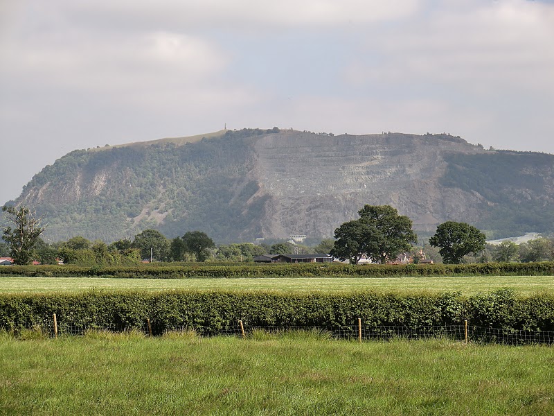
Massive Horton quarry dwarfing the village - those who complain about Hope Cement works in the Peak District should come & take a look at the Yorkshire Dales National Park!
In fairness, the quarry has won awards for its conservation work

Finished the day here but, unlike these 'Three-Peakers', I hadn't had enough of the sun & sat in the garden at the back! Been here before - good pint!
Tuesday 11th October
Day 50 colluders!
Craven Dale to Malhamdale

Exchanged the Leeds-Liverpool Canal for the River Aire shortly after Gargrave (too early for a beer!)
Shared this stretch with several groups of DofE teenagers in various states of disrepair.... obviously beginners!


Above: old mill at Airton, now converted to smart-looking flats
Originally a corn mill, owned by Bolton Priory & driven by the River Aire; it was converted, as were many others, to cotton-spinning in the 19th century
Right: can find no reference to this but assume it to be a depiction of St Francis of Assissi - found it in horse-mad Hanlith, so it would be appropriate!

First glimpse of Malham Cove & tomorrow's walk.....

'The Buck Inn', Malham - not as old as it looks, being converted from a coaching inn as recently as 1874
I thought it a bit too big for its own good, entering one door & wandering cold, empty rooms looking for an open bar, before finally finding one at the furthest end of the building!
Monday 10th October
Day 49 clay-pigeons!
Oakworth Moor, Ickornshaw Moor, Stott Hill Moor & Elslack Moor!

Lower Laithe Reservoir
Headed off beside the reservoir & through the village of Stanbury where, inevitably, there's a pub named 'Wuthering Heights'!

Ponden Reservoir
Over 50 years older than its neighbour, Lower Laithe, Ponden was built to supply the mills of the Worth Valley - now it provides drinking water for Keighley
Passed dozens of reservoirs over the last couple of weeks; suddenly, this was to be the last!

Should have been my second pub of the day but for closures! Closed pub had been on the main A6068; this is in a tiny & quite remote village... but they get an excellent write-up from the Keighley & Craven CAMRA branch!

Barnoldswick in the Craven Valley & on the edge of the Forest of Bowland
Highest town on the Leeds-Liverpool canal & a reminder that, whilst I might be done with reservoirs for the time being, there were still many canal-miles still to be walked!
Interesting footnote: the RB model number on many jet engines stands for 'Rolls Barnoldswick' - the Rolls Royce aero-design centre was located here in an old cotton mill bought by the company in 1943!

'The Tempest Arms', Elslack - named Pub of the Year for 2011 & it's just down the road from today's finishing point at Thornton-in-Craven..... now there's good planning!
Sunday 9th October
Day 48 churls!

Attractive centre of a lovely town; usually much busier but I took this quite early in the morning!
Have eaten & drunk at the 'Shoulder of Mutton' on several occasions - good pub!


The sculpture in the top picture is a large-scale replica of a fustian needle
Ribbed fustian is heavy-duty ribbed cloth such as corduroy which was manufactured in the town
The special needle was originally a hand tool but was later incorporated into a loomAbove Left: the base of the sculpture depicts significant local images connected with the industry - the needle points due north to Nutclough Mill, home of the fustian industry &, in its day, the largest worker-producer co-operative in Britain
Above Right: Millennium Clock, Hebden Bridge

... and this is where the town gets its name!
500-year-old packhorse bridge over the River Calder on the old cross-Pennine route from Halifax to Burnley

I was up there yesterday!
Stoodley Pike Monument, high on the edge of Langfield Common to the south of the Calder Valley
Now I was climbing to the north towards Blackshaw Head

Gorple Lower Reservoir on Heptonstall Moor with Black Moor beyond

Walshaw Dean Middle Reservoir on Wadsworth Moor
Interesting footnote: Walshaw Dean can be found in the list of all-time UK weather records, recording 193 millimetres (7.6 inches) of rainfall in one 2-hour spell in May 1989!

..... & that's probably why these reservoirs need such huge drains despite their low levels this Summer
This is the Head Drain beside the 3 Walshaw Dean reservoirs which empties into Alcomden Water & subsequently Hebden Water before crashing down to the Calder
Note the wonderful wild rhododendrons again!

An almost constant stream of strollers, many woefully ill-prepared, making their way across Haworth Moor to the remote Top Withins
The paths are not particularly difficult but it's quite a long way from the village

Picnickers, dog-walkers & the likes of me made this probably the busiest of any moorland walking on the whole of LeJog
What on earth would it have been like at a weekend?!
Bronte Bridge,
South Dean Beck
Some of the picnickers only made it as far as this lovely spot!The original bridge, referred to in Charlotte's diaries, was destroyed by a flash flood on 19th May 1989, the same day as Walshaw Dean's record rainfall!
It was rebuilt the following year

Yet another reservoir! Lower Laithe, close to the villages of Stanbury & Haworth
Work began on this in 1914 but, because of World War I, it was not completed until 1925

A veritable sun-trap!
Saturday 8th October
Day 47 chancers!
Another day on the high moors.... one of the very best of the whole LeJog!

Looking over the village of Delph to High Moor from a point just above Brun Clough Reservoir
Really strange to think that underground, hundreds of feet below me, a canal tunnel & a railway tunnel had been bored through the hills!

Castleshaw Reservoirs with Delph, again, to the left

Popular lorry-drivers' transport cafe on the A672 at Windy Hill, just above Junction 22 of the M62.... you can't hear it & it's only visible away to the east - slightly surreal spot!

That's better!
The motorway runs along a cutting blasted through moorland rock - that's why it's invisible... & silent!
Pennine Way crosses on a narrow footbridge strung high across the carriageways

Hollingworth Lake & Littleborough from Blackstone Edge
The lake was constructed as a feeder reservoir for the Rochdale Canal as, such was the importance of Littleborough's mills & the power of their owners, there was resistance to the 'new' waterway drawing from local rivers & streams & tapping existing energy supplies
It's now a Country Park: home to a rowing club, a sailing club & Sea Cadet activities


'The Aiggin Stone', Blackstone Edge
Stands directly on the Yorkshire-Lancashire border & beside the route of an old Roman Road; it's believed to be a waymarker for an old cross-Pennine packhorse track

'The White House', Blackstone Edge - the only Lancashire pub visited on LeJog... but I was in the County for barely an hour! Sampled an extraordinary cider here that I haven't been able to track down since
The pub was built in 1671 as the 'Coach & Horses' & was re-named in 1930; its main claim to fame is as the site of a huge gathering of thousands of Socialists from neighbouring mill-towns, on both sides of the 'border', in May 1888

Blackstone Edge Reservoir - felt like the top of the world! Lots of people wandering along the easy, level track from 'The White House'.... & this connects with several others
Could be a place to walk when I'm too frail to tackle anything else!

Wicken Lowe - high on Chelburn Moor
Couldn't resist this photo; the pylons & signpost are interlopers but actually give the landscape some character.... & it isn't really 'tamed', you know!

This huge expanse of moor-top water was defended by still-visible sunken barges in World War II - it was feared the enemy might attempt to land seaplanes here

Warland's Head Drain which collects water from Langfield Common, Walsden & Withens Moor
Keen observers will note the still-alarmingly low level of water reserves... maybe it's a good thing the sky saw fit to sort things in the coming weeks!

'The Long Stoop' standing stone, to be found on Langdale Common above Mankinholes village
Medieval waymarker on the Todmorden to Sowerby packhorse route
I'd approached this 9' stone from a completely different direction when walking the 'Calderdale Way' in heavy mist a couple of years ago. Today, I didn't recognize it.... even though I knew it was there!
So much for my navigation!

In fairness, why worry about navigation when visibility is so good & the views so special?!
I'd been aiming for Stoodley Pike Monument for a while & was looking forward to climbing it - first time I'd ever been here in clear conditions!

Todmorden & the Forest of Rossendale beyond, from Stoodley Pike's platform
Not on this walk but an oft-visited little Calderdale town
Train & buses from here provide easy access to the moors... West Yorkshire Tourist Board, just contact me via the blog-site!

Hebden Bridge & the Rochdale Canal
Our van was built just down the valley in Elland so we've been here quite a lot recently - fascinating canal-walking & Hebden Bridge is a lovely little town
Friday 7th October
Day 46 changelings!
Wessenden & Saddleworth Moors
 Crossing the dam between Longdendale's Torside & Rhodeswood reservoirs Very damp & misty after the previous day's heavy rain - not a particularly good day for moorland visibility!
Route-finding not particularly easy - despite this being the Pennine Way the way is not always obvious with tracks heading off aimlessly into dense heather or, more purposefully, to running water
In the end I settled for the latter & followed Crowden Great Brook, despite its waterfalls, until the various tracks seemed to converge to climb to the cloud-hidden trig pillar on Black Hill
 No sunshine yet but a couple of hundred feet below the summit &, quite suddenly & beautifully, Wessenden Head Moor opened up for the first views of the day!
Didn't stop here for a pint.... it was demolished years ago!
Apparently, a favourite on the cross-Pennine route at Wessenden Head which is now the A635. Conflicting references suggest that it was knocked down after a fire or removed in fear that it might contaminate water supplies from nearby reservoirs - there is a borehole very close to the original site
Interestingly, Government documents dated 1974 suggest that the land here is not 'owned'
My 'best shot' is that there was once a large quarry above nearby Meltham village, named the 'Isle of Skye Quarry'!

I left the rhododendrons behind & headed west across Black Moss, more moorland!

Blakeley reservoir is at the top of the picture: a storage reservoir, opened in 1903 to serve Huddersfield


First pub stop of the day at Marsden's 'The Railway'; beside the Huddersfield Narrow Canal & cross-Pennine railway in the narrow Colne valley - we'd come to see 'the highest, deepest & longest canal tunnel in the UK'

'Marsden & its Canal' by Mick Kirkby-Geddes
Lured by sculptures again! One of four sculptures commissioned to depict the Huddersfield Narrow Canal & the Colne Valley; this one stands outside the 'Riverhead Tap Brewery' in Marsden
Thursday 6th October
Day 45 charlatans!
Only day of the whole LeJog that activities were curtailed by the weather!

Heading down Torside Clough to Torside Reservoir, the largest of the Longdendale chain & built in 1849 to supply water to Manchester. When the whole project was complete, in 1877, the damming of the River Etherow had created, what was then, the largest artificial expanse of water in the world
The old Manchester-Sheffield railway line runs along the nearside of the reservoir & was a reasonably dry end to the walk after splashing about on the moorland! Part of the Trans-Pennine Trail which runs across Europe from Liverpool to Istanbul - didn't quite feel up to that today but there's an idea for a future project!

Home of the Glossop & District Sailing Club; I was surprised to see so many yachts scudding about in these conditions - most of them had given up by the time I'd reached the end of the reservoir & was headed for the shelter of our campsite!
Wednesday 5th October
Day 44 chums!

Moaned enough about 'The Old Nags Head' at Edale in the original blog!
Suffice to say that I took this after we'd had a pint, the sun was coming out & we were going for a walk!

Beautiful Vale of Edale looking wonderful in the afternoon sunshine with the Mam Tor Ridge rising across the valley floor
Those dark clouds, though, were saving up a little hailstorm for later!

Descending to the foot of Jacob's Ladder at the head of Edale with Crowden Tower above, on the edge of Kinder Scout & Edale Moor
If you've never walked here, as you can see, the route is easy to follow & the views spectacular.... but don't expect to have it all to yourself!

Looking back down Edale from about half-way up Jacob's Ladder

.... & if we had it all to ourselves there'd have been nobody about to take our picture on the summit of Kinder Scout!
Highest gritstone peak in the Peak District, I can never understand why the trig pillar is sited at a point named Kinder Low!

Weird & wonderful gritstone shapes sticking up from the eroded peat around Kinder Low

Kinder Reservoir, unsurprisingly fed by the River Kinder which crashes down from the plateau in the Peak's highest waterfall
More interesting is the fact that this was originally called 'Kinder Scut', from which the whole moorland area derived its current name!


And, at the point where the 'Pennine Way' meets the track up William Clough from Hayfield the 'Snake Path', thoughtfully signposted, takes off below Black Ashop Moor for another of my very favourite pubs.
But, if you do this walk, don't be fooled; it's not just round the corner!

Kinder Scout - scene of the infamous 'mass-trespass' on April 24th 1932
Organized to challenge 'landowner's' rights to deny public access to open country, it resulted in 400-500 walkers, mostly from Manchester, marching on Kinder Scout where a small proportion were involved in a fight with gamekeepers
5 walkers were arrested & given prison sentences.... but not for trespass
One of the outcomes was the establishment, in 1947, of a Government committee which recommended the establishment of 12 National Parks which was recognised by an Act of Parliament in 1949
The last of these 'Parks', the South Downs, was not established until 2009, 60 years later!
The Peak District, established in 1951, was the first!
A couple of verses from Ewan MacColl's 'Manchester Rambler', my 'Song of the Day' on LeJog!
The day was just ending and I was descending
Through Grindsbrook just by Upper-Tor,
When a voice cried, "Hey, you!", in the way keepers do,
(He'd the worst face that ever I saw).
The things that he said were unpleasant;
In the teeth of his fury I said
"Sooner than part from the mountains,
I think I would rather be dead"
He called me a louse and said "Think of the grouse".
Well I thought, but I still couldn't see
Why old Kinder Scout and the moors round about
Couldn't take both the poor grouse and me.
He said "All this land is my master's".
At that I stood shaking my head,
No man has the right to own mountains
Any more than the deep ocean bed
Interesting footnote: the 'Countryside & Rights of Way Act' (2000) which opened 'Access Ground' to the public has still not been fully implemented, almost 80 years after that 'trespass'!
Rant over!!
Tuesday 4th October
Day 43 companeros!
One of my finest LeJog decisions was to adjust my route to take in the old industrial areas of Whaley Bridge, Buxworth, Whitehough & Chapel Milton rather than heading across country to the Peaks from Toddbrook Reservoir. I knew little about the area & on the OS map it looks 'messy'.... turned out to be amongst the very best & most interesting of days!

Already a busy & prosperous coal-mining area before the opening of the canal in 1796; unusually, the arrival of the railway 35 years later made the basin even busier with the new Cromford & High Peak line bringing limestone & burnt lime for shipment to Manchester & beyond

Only a mile from Whaley Bridge is the bigger, busier & more important Bugsworth Basin - the end of the Peak Forest Canal & the very heart of industrial activity in the area
A scheduled Ancient Monument since 1977

The only one of four 19th century pubs still to stand at Bugsworth Basin - good selection of Real Ales!
Interesting Footnote: the pub was once owned by actress, Pat Phoenix

The 14-mile canal was built between Dukinsfield & Bugsworth by Benjamin Outram & by the end of 1796 a 6-mile tramway linked the Canal Basin to the limestone & gritstone quarries of the Peak, most significantly to Dove Holes
Stone was processed, graded & shipped from here for over 100 years, the tramway finally closing in 1924


The further of the two was built in 1867 & once carried the express line from London to Manchester
The nearer, built in 1890, links with the Sheffield-Manchester line
Still both in use &, ironically, are important in the shipping of stone from the quarry at Buxton

Amazing to see 19th century terraced cottages & modern 20th century homes similarly shadowed by these mighty edifices!
Weather took a turn for the worse as I headed along Rushup Edge towards Mam Tor & the horseshoe of hills around Hope Valley.... but it takes more than a little hail, sleet & rain to spoil these views!

Mam Tor - known as 'The Shivering Mountain' because of the instability of its shale
The only shivering today was on account of the weather!

'The Rambler Inn', Edale - one of my favourite Peak District pubs, though I have read a couple of unfavourable reviews
Good beer, friendly welcome & they were interested in LeJog: must try & visit in the sunshine some time!
Monday 3rd October
Day 42 collaborators!
Macclesfield Canal at Lyme Green

All looking very peaceful & pastoral now but this was once at the centre of the town's industry
Known locally as 'The Bone Works', it was the site of a knackers yard, manufacturing glue from recycled horses

Bridge 43 at Gurnett, Macclesfield: a 'change' or 'turnover' bridge, allowing horses to switch banks without unhitching from the barge
An unusual canal feature but there are 6 of them on 'The Macc'

The Bollington Labyrinth
Constructed from 148 locally-quarried stones as part of the 2009 Bollington Festival
The Labyrinth stands beside the Middlewood Way, a cycletrack following the trackbed of the old Macclesfield, Bollington & Marple railway which closed in 1970 & lay derelict until 1986 when Macclesfield Canal paid £1 for the Dean Valley viaduct & restoration work began!
Left : The Adelphi Mill, Bollington
 Impossible to photograph from the canal - it's too big! So, a rear view! Built in 1856 by brothers George & Martin Swindells who adopted the Greek word for 'brothers' as the name of their mill - the impressive turretted water-tower was added in 1907 & its chimney, long demolished, was 176' in height! Manufacturers, at different times, of cotton, silk, rayon & nylon; the mill finally closed in 1975 & has been recently refurbished to house modern office space & a Health & Fitness Club!
Clarence Mill, Bollington - also offering modern office space & boasting the town's Discovery Centre.... not open on the day of our visit!

Another view of Clarence Mill from the start of the climb to 'White Nancy
An enormous mill & even more impressive than the 'Adelphi' because it's managed to hang on to its chimney! The housing on the skyline is Bramhall, a suburb of Stockport

View from the east-facing slope of Kerridge Hill which towers above Bollington


The day's 2 equally fine hostelries!
Left: 'Bulls Head', Bollington where the very fine publican opened early just so he could serve me a pint!
Right: 'The Swan Inn', Kettleshume - I'd arranged to meet Les here for a drink & was alarmed to find what I imagined to be the village pub closed down! A few hundred yards further on & I found 'The Swan' & Les patiently sitting outside in the glorious sunshine!
Sunday 2nd October
Day 41 comrades!

Taken lots of pictures of ducks over the years & LeJog was no exception! Don't recall seeing too many albino ducklings, though
Spotted this small family just east of Hassall Green

Designed to speed up traffic & conserve water, this pair are east of Hassall Green

Another view of Little Moreton Hall - 'There was a crooked man......!'
Not far from Congleton, I'd headed for Mow Cop & the Gritstone Trail while Les explored this superb moated 15th century half-timbered manor house
Originally built for Sir Richard de Moreton, subsequent generations of his family added their own bits & pieces & that, ultimately, caused the unique lopsidedness!
The weight of the third-storey's glass, timber & gritstone slates has caused the buckling & bowing of the first two floors

Yet another branch of the Midland Canal Network! Now I'm crossing the 'Cheshire Ring' below Mow Cop.... the 'Macclesfield Canal' that I was to rejoin later!

 I always think it would be wonderful if Mow Cop Castle was a real castle instead of a folly!
Built ny Randle Wilbraham in 1754 as a summerhouse, its cliff-top setting is quite magical!

Old Man of Mow
Mow Cop Quarry was famous for its high quality millstones & querns have been excavated dating from the Iron Age
There's also evidence that this was the site of a prehistoric settlement

Congleton Edge

'The Fools Nook' - excellent pub on the Leek Road just outside Macclesfield & right beside Telford's canal
 Both Les & I have already written about the kindness of the owners & the locals after Les' 'close encounter' with a white van but here's a couple of other interesting facts about the place that I didn't have the space for last time around!
The pub was originally named 'The Royal Oak' & was established in an existing row of cottages to provide refreshment for Telford's navvies; the cottages were demolished in 1839 & the current pub built on the site in 1841; bought by Higson's Brewery of Liverpool in 1962, it became 'The Fools Nook Inn' at the Christmas of that year & its original sign is on display in the bar
You'll have to look at the original blog for the story of the pub's name!
Ironically, of the 328 postcards I sent on LeJog the only one to go astray was sent from here - to my local 'The Swiss Bell'!
Saturday 1st October
Day 40 cahoots!

Back with the Shropshire Union Canal proper & a particularly busy (& incredibly straight!) stretch between Market Drayton & Nantwich
Hack Green 'Secret' Nuclear Bunker, decommissioned in 1993, is about a mile along the canal on the right hand side

Interesting footnote: Audlem station, about a mile in this direction, is mentioned in Flanders & Swan's lamentation on the demise of the railways, 'Slow Train'!

The current renovation of this 18th century building has been under way since 1989! Apparently, it was roofless & almost totally derelict, having stood empty for years
Bits of Hankelow Hall date from the 14th century


Huge downpour shortly before I reached the recently refurbished 'White Hart' in Hough & steam was rising from the rapidly drying tarmac!
Met Les here for a quick pint & were surprised to find we were the only ones in this very good pub

Surprised to 'cross swords' with this waymarked path just outside Crewe!
A 29-mile walk that doesn't appear in my UK Trailwalkers Handbook but I'm guessing the swords refer to the Civil War's Battle of Nantwich & the wheel, perhaps, to the town's place on the old Tudor trade route from London to Ireland
Friday 30th September
Day 39 concessions!

Had been flirting with the Border since Day 25 but this insignificant-looking bridge over the Wych Brook in Higher Wych marks the point at which I crossed from Wales to England for the final time!

Llangollen branch of the Shropshire Union Canal climbs from the Cheshire Plain at Grindley Brook via this 3 lock staircase & 3 other independent locks in the village
Lovely spot to waste a bit of time watching boats!

Once clear of Grindley Brook & the bustle is quickly left behind.....

Left the canal just after Grindley Brook, crossed the disused Whitchurch & Tattenhall railway line (closed in 1965, though Grindley Brook Halt hadn't been used since 1957), joined the South Cheshire Way & headed across country for Marbury.... all to cut out a huge loop in the Shropshire Union!
The route passes through several low-lying watery meadows & past overgrown woodland on the edges of once-grand estates - the houses are still there &, mostly, with fine gardens, it just seems to be the fringes that they've forgotten!


'Dusty Miller' - smart Robinsons canal-side pub at Wrenbury
A converted 19th century corn mill but I don't think you need the pub sign to help you work that out!
The rare single-span timber lift bridge, though, is interesting; one of 3 along this stretch of waterway & built by a young Telford in the 1790s - this one has been mechanised but still carries main road traffic over the canal.... very slowly!
Wednesday 21st September
Off to the South Coast for a few days (that holiday I was promising the manager!), so won't be adding to LeJog pictures until next week. Internet access permitting I'll be updating the Home Page with 'new' walks.... perhaps that should be Les & weather-permitting!
Day 38 bit-part players!

Gardens in Chirk overlooking Telford's aqueduct
Robertson's railway viaduct, which crosses the Ceiriog alongside, was built 47 years later &, it is suggested, 30' higher just to emphasise railway supremacy!
Still has 10 arches, though!

Didn't walk right in
to Ellesmere, that would have been an extravagant diversion even by my standards!
Have since discovered that there's a sculpture-trail in the town; now, if I'd known that before....!
Tuesday 20th September
Day 37 buskers!
Pontcysyllte!

Remains of Oswestry Racecourse Grandstand - built in 1804 & a favourite haunt of Mad Jack Mytton!
 Closed after the last race in 1848, partly because of the increasing rowdiness & drunkenness of spectators but also the fact that improved transport made bigger courses like Chester more accessible
Became home to a family of mole-catchers before it fell into disrepair!

This is on the Froncysyllte side of the aqueduct & is dedicated to 'Canada Bill' who was employed at Chirk Limestone Works - it is alleged that he married a Canadian.... but never went to Canada himself!


(Left) Crossing towards Trevor Basin : (Right) Looking back towards Froncysyllte


Described by Sir Walter Scott as 'the most impressive work of art I have ever seen', I can't understand why it took UNESCO until 2009 to add the Pontcysyllte Aqueduct & 11 miles of the Llangollen Canal to their list of World Heritage Sites! Now it's on there, along with the Taj Mahal, the Acropolis, the Great Wall of China..... Ironbridge/Coalbrookdale & bits of the Derwent Valley!
Another couple of those sculptures I seem to be drawn towards: the one on the left depicting Trevor Canal Basin, that on the right dedicated to Telford's 'Stream in the Sky'!

Lots of activity at Trevor with narrow-boats queuing to cross!
 The day's 2 pubs: 'Aqueduct Inn', high above the canal at Froncysyllte & 'Telford Inn' at Trevor Basin (Telford lived here for a while during the aqueduct's construction)

Alternative to a complex system of locks - just sail straight over the Dee Valley & its river!

18 huge pillars of local stone, hollow at the top to reduce their weight, supporting an iron trough whose plates were cast in a local foundry built specifically for this project
Although it took 500 men 10 years to construct, within a further 5 years the owners had recouped all of their expenses
When refurbished in 2005 only a handful of seals, nuts & bolts needed replacing!
Monday 19th September
Day 36 bulwarks!

 Discovered by the canal at Four Crosses &, naturally, I couldn't allow the man to go uninvestigated!
Born in 1924, Powell was to be regularly seen in the 1940s & 1950s fighting at such exotic venues as the old Oswestry football ground & the West-Mid showground in Shrewsbury but he never gave up the day-job - working up radio masts in nearby Criggion!
He fought over 60 bouts in the 5 year period up to the final defence & loss of his title - not sure that professional boxers would be up for that work-rate these days!
Interestingly, the man he defeated to become champion was George Walker who went on to become one of the wealthiest & most successful entrepreneurs of the 1970s before his 'fall from grace' in 1980

Old warehouse & loading-gear beside the canal at Pentreheylin

 Brake Drum House at Llanymynech Quarry & the Brakeman (usually a young boy!), whose job it was to control the movement of limestone-filled trucks up & down the steep hill
The Tally-House where quarried limestone was weighed & the workers' wages calculated accordingly!


The Hoffmann Kiln
Designed to use a continuously-burning ring of lime, it was cheap on fuel but very labour-intensive
This kiln was built in 1899 but shut-down at the beginning of World War I because of a shortage of willing & able workers. It served as a cattle-shed for more than 60 years before its restoration

Superb sculpture beside the canal at Llanymynech

Whitehaven Quarry from Porthywaen, site of its supporting limeworks - closed in 1951

A day of excellent visibility finished with this hill-top view from Moelydd
Sunday 18th September
Day 35 balusters!

Mid & North Wales had been a Royalist stronghold but the town & castle of Montgomery fell to the Parliamentarians in early September. A large Royalist army attempted to recover lost ground but a swift & decisive battle saw them defeated

The Montgomery Canal was opened in sections by 3 companies between 1796 & 1819; it was mainly used to carry limestone & then lime to neighbouring farms
At its peak there were 8 working kilns close to the Belan Locks
The canal closed to commercial traffic in 1936


Superb carved seat outside Welshpool's Powysland Museum - would have loved to learn more about this & the significance of the unusual sculpture on the right... but they were closing for lunch!

Established in 1874 by local members of the Powysland Club who had an interest in Welsh history; it was moved to these old warehouse buildings beside the canal in 1990... supposed to be very good!


An 18th century roadside coaching inn strategically-sited between the Montgomery Canal & the River Severn
Pool Quay is a tiny village but was an important river port, before the advent of the railway
Refurbished in 2007, it is now officially known as 'The Quay', its nickname for centuries!

Impressive & unusual swan sculpture at Burgedin Locks
If you look carefully you might spot 'Rodney's Pillar' on the summit; it was erected in honour of Admiral Rodney whose fleet was built from oak wood shipped down the Severn from here to Bristol
For many years, from 1789, the Hill & Pillar were the venue for an annual festival of food, drink, song & poetry

Lovely pub garden to finish in - an oasis in the middle of road-building & noisy earth-shifting operations!
Saturday 17th September
Day 34 bric-a-brac!

Mount Bank
Shortly after the start of today's stretch from Newcastle & the beginning of what I think is the toughest bit of the Offa's Dyke Path

Valley of the River Unk in Lower Edenhope
Small river which joins the better-known River Clun a bit further downstream
Didn't see a soul on any of these hills!

Majestic gatehouse of the even grander Mellington Hall! Scandal, however, lurks behind the Gothic facade of this 18th century mansion turned hotel - it was forced to close temporarily earlier this year after a string of food-hygiene offences

Another view of Montgomery Castle
13th century border castle designed by the same architect responsible for White Castle, visited a few days ago
Its main claim to fame is the fact that it repelled an attack by Glendower's forces in 1402
Friday 16th September
Day 33 Beautiful Losers!
Visitors, barbecues & sunshine!
 Looking down on Knighton from Panpunton Hill - tough climb to start a walk!
Les & Carol setting out beside the River Teme in Knighton
The whole of the river was designated a SSSI in 1996, mainly because of its variety of fish

By now we were walking along the Jack Mytton Way as well as the Offa's Dyke Path
Named after Mad Jack Mytton, it would be difficult to imagine someone less worthy of having a long-distance path named after them! Expelled from Westminster School for fighting with a Master, he survived only 3 days at Harrow before expulsion! His annual income (£750,000 in modern terms) secured him a place at Cambridge University & he took with him 2000 bottles of port to help him with his 'studies'; he was bored, however, & left without graduating. He became MP for Shrewsbury, bribing voters with £10 notes, but attended Parliament only once (for 30 minutes!).... he found that boring, too!
Sounds like there's hope for a Bernie Large Way yet!

Llanfair Hill with Offa's Dyke carving up its centre, followed by the line of trees & bushes
Beautiful walking country, especially in this weather!

Looking back on the morning's efforts - splendid stuff!
Thursday 15th September
Day 32 bed-fellows!

Mrs Price at Walton Court Camping & Caravanning Park has a fantastic craft-shop type place(!) full of fascinating bits & pieces made by herself & her friend: cards, cushions... all the way through to furniture & this fine owl!

Another view of Kington Golf course & the clubhouse on Bradnor Hill, spectacularly overlooking the 18th green & the small town below

Strange directional quirk of the Offa's Dyke Path, my route.... or both! The hump-backed wooded hills (centre top) are Navages & Worsell Wood, with Hergest Ridge to their left


Monument on Hengwm Hill erected to a local Radnorshire baronet - superb setting!


Clock-tower in the centre of Knighton... & the sun is shining at last!
'George & Dragon', Knighton: wonderfully friendly pub & home to 'Rev.James Ale' - one of the best on the whole LeJog
Wednesday 14th September
Day 31 back-ups!
Hergest Ridge in clouds!

The walk I'd have done again the next day if I hadn't been able to see much! Hills to the north of Hergest Ridge
The outlines of an old racecourse can still be seen on the summit: horses last raced here in the summer of 1880

Nearby are the ruins of 15th century Hergest Court where the medieval manuscript 'Red Book of Hergest' was preserved. Origin of 'The Mabinogion', legendary tales of Celtic mythology, there are also references to that man 'Arthur' again!

Another view of the curious wooded spine-backed hills below Hergest Ridge
Worsell & Navages Woods - there's a series of 3 burial cairns close to the summit of Worsell Wood

End point of a short day in a very quiet Kington: an early 19th century listed building...... but that's not why we stopped here!
Sampled 'Harvest Pale', one of the best ales of the whole LeJog
Tuesday 13th September
Day 30 attachments!

The Wye, here, marks the northern boundary of the Brecon Beacons National Park & is a very popular canoeing venue - boats for hire & tuition available just downstream, at Glasbury!

Tiny village of Newchurch: on the River Arrow & nestling in a small hollow on the edge of the rolling Radnorshire Hills

Beginning the climb into those hills! Half-way up Disgwylfa but the surrounding Bryngwyn, Newchurch, Black & Colva Hills are much higher
Superb walk, quickly leaving farmland for high, open pastures
Monday 12th September
Day 29 acolytes!
Black Mountains

My route up Hatterrall Hill to Upper Pentywyn from the previous night's stop-over at Pandy, down in the Monnow Valley
Steep start to the day!

Another view of the trig pillar on Hatterrall Ridge, this time looking eastwards over Olchon Valley

Best explanation I've found describes it as 'an art, discipline or hobby depending upon the intent of the practitioner'
Lot of practitioners about!

Reached the highest point on Offa's Dyke path, just over 2300', at Red Daren; the route then swings around Hay Bluff to the end of theRidge & this view of 'The Riggles', source of the River Monnow

Descending Hay Bluff... knee-rattling stuff!

Approaching Hay-on-Wye with Clyro Hill in the background
Sunday 11th September
Day 28 appendages!
The Monnow Valley

Looking across the beautiful farmland of the Monnow Valley towards the sharp edge of Hatterrall Ridge & the bleakness of the Black Mountains... expecting a storm!

Skirrid from White Castle
The mountain is also known as St Michael's Mount after the ruins of the ancient St Michael's Chapel on its summit
Locally, it is commonly referred to as the Holy Mountain

Llangattock-Lingoed
St Cadoc was a contemporary of St David, St Patrick & St Columba & one of the most important Welsh saints
Built from local stone, the rendering & limewash was restored in 2003 so the white church now looks as it did when built in the 13th century

The start of tomorrow's steep climb to Hatterrall Ridge


17th century pub no more than 100 yards from our campsite! The old fulling mill, now a bunkhouse, is behind this main building & across a courtyard, on the banks of the River Monnow. The Welsh word for 'fulling' (cleaning cloth) is 'pandy'... hence the name & the name of the village!
Very good pint of 'Butty Bach' here but, sadly, a bit too wild to sit outside!
Saturday 10th September
Day 27 ampersands!

Monmouth Rowing Club
On the River Wye, just to the north of the town, & venue for a popuar annual Spring Bank Holiday regatta

Founded in 1615 & rebuilt in 1865, the original funding came from William Jones, local haberdasher made good!
The school has produced 3 Olympic rowing medallists including Colin Moynihan - rather less successful as a politician, I would argue!
Derek Ezra, former National Coal Board chairman, is also a former pupil

 Left: Charles Stewart Rolls, co-founder of Rolls-Royce & the first Briton to be killed in a flying accident, aged only 32. His ancestral home was The Hendre, just outside Monmouth & close to my cider-apple route!
Right: Henry V was born in Monmouth Castle & was King of England from 1413 until his death, aged 35, in 1422.
Most famous for his victory over the French at Agincourt


'The Robin Hood Inn' is one of Monmouth's oldest buildings - its amazing front door dates from the 16th century whilst, in the 18th century, one of its upper rooms was secretly used to celebrate Mass

Monnow Bridge & gatehouse: built about 1270 as part of the town's defences. The only surviving medieval bridge in Britain with a gate-tower standing on the bridge, it has also been used as a toll-house & a jail!

Monmouth Millennium Plinth
Fascinating & beautiful tile display of the town's history - how on earth do you get a good photo of this without erecting scaffolding?!

Looking across the Trothy valley towards Skirrid & Sugar Loaf - they were to be a feature on my horizon for several days
The valley is full of orchards bearing the 'Bulmers' tag & my route marched straight through the middle, close to Rolls' family home


 Above: 'The Green Man', pagan
 fertility symbol in St Teilo's Church, Llantilio Crossenny
Right: White Castle - remains of one of the three Norman castles in the Monnow valley
Originally named Llantilio Castle, it earned its modern name because of the white rendering which once covered its exterior walls!
Friday 9th September
Day 26 allies!
Mystical, magical Welsh wizardry!

Arrived at Beeches Farm, above Tidenham village, in a howling gale & heavy, low cloud - the farmer's wife advised us to park up behind the hedge to make sure we weren't blown over!
This was our morning view across the Wye valley!

The Old Road Bridge across the River Wye in Chepstow
Opened in 1816, it spans the second highest tidal range in the world - it is not unusual for it to exceed 46' in a single tide!
The Romans managed to build a bridge just upstream from here

Apparently the hole opens into a large chamber inside the limestone cliffs & one story tells of Brunel storing explosives here when he built the railway. The Union Jack was first painted by local fishermen to celebrate the silver jubilee of King George V in 1935
High-tide line is clearly visible.....!

Wintour's Leap, near Woodcroft village
Named after Sir John Wintour who, according to local legend, rode his horse over this cliff when pursued by Parliamentary forces, then swam downriver to the safety of Chepstow Castle!

Sir John Wintour's swim! View down the Wye towards Chepstow from Wintour's Leap


Tintern Abbey
Founded by Walter de Clare, Lord of Chepstow, in 1131. The first Cistercian abbey to be built in Wales & only the second in Britain, after Waverley in Surrey


Two views of the nave of the Abbey church
Wealthiest of the Welsh abbeys, this is reflected in its majestic arches & windows


Above Left: Sabrina, Goddess of the River Severn - her Welsh name is Hafren
Above Right: King Arthur (Y Brenin Arthur) - possibly the hereditary king of the Silures tribe who inhabited south-east Wales or, to quote Winston Churchill," It is reasonably certain that a petty chieftain named Arthur did exist, probably in South Wales"!

 Left: Eleanor of Provence - Queen of Henry III, mother of Edward I & hated by the English! Right: Geoffrey of Monmouth, an early historian & later Bishop of St Asaph who wrote the 'History of the Kings of Britain' from a Celtic point of view - it's from his writings that the Arthurian legends stem!
Above: King Offa, ruler of Mercia from 757 - 799 AD; his 'Midland' kingdom included all of England south of the Humber. After annihilating the Welsh in 787 he constructed his huge Dyke to define the boundary of his territory & to show who was boss, just in case anyone was in doubt!

Tintern Railway Station - opened in 1876, closed to passengers in 1959 & to freight in 1964 when the Wye Valley line closed completely. The walking, the river, the abbey & the Circle of Legends make this worth a visit any time!

'The Anchor', Tintern
First pint of Weston's 'Old Rosie' here - best cider of the whole LeJog & an excellent pub!
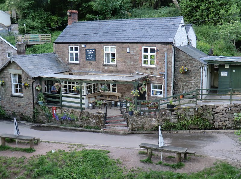
The day's second pint of 'Old Rosie'!
The River Wye, the border between England & Wales at this point, runs through the village. The pub is on the Welsh side, in Monmouthshire, & is only reachable on foot over the old railway bridge. Directed here by the landlady of the 'English' pub - she was shut!
Thursday 8th September
Day 25 augmentations!
From one great river to another....

My route out of Bristol took me along the pavement beside this road, further than the eye can see.... not my favourite bit of LeJog!
Scaffolding near the centre currently shores up the wall along Bridge Valley Road
The Pier Railway (1860s) once ran through tunnels here; this was closed some 40 years later & then a tramway (1920s) was constructed using part of the route. In World War II the tunnels were used as an air-raid shelter
Historical rather than industrial but fascinating nonetheless!

'New' Severn road bridge which now carries the M4 over this mighty river & into Wales
One of the reasons for building this was the fact that the original was often closed in high winds - the shape & siting of this has overcome that problem.... but you're not allowed to walk over it!

Opened in 1996, 30 years after the first bridge, the crossing is 3.2 miles in length. It has, in fact, been closed by adverse weather..... falling ice shattering windscreens!

225 miles in length, the Severn Way can be followed from Llwybr Hafren Plynlimon to Bristol though, officially, the path ends at the M4 bridge after 211 miles
Britain's longest riverside walk - I quite enjoyed this stretch after my battle with the Avon Link section!


Not the greatest pub I've ever visited but, after crossing the Severn & doing battle with the wind, one of the most welcome! Warm, dry & quiet... even if the beer was a little dull! Particularly interesting is that this is the home of the Chepstow Acoustic Music Club & upcoming live guests included Steve Ashley, Quicksilver & Martin Simpson
Wednesday 7th September
Day 24 affiliates!
The Brunel Day!
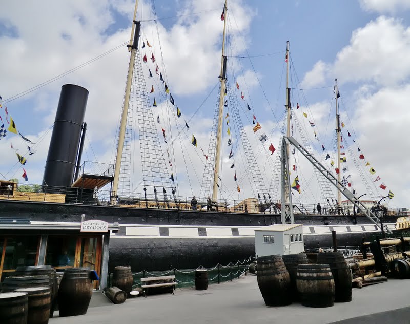
SS Great Britain
Launched in 1843, she was the largest ship in the world; over 100' longer than any of her rivals, she was also the first screw-propelled, ocean-going, wrought iron ship
 Designed as a paddle-steamer, her engines were converted to make use of the new propeller technology
She began her life as a luxury transatlantic liner, carrying 252 passengers & 130 crew


First Class cabin (bit small!), First Class cabin service & First Class dining facilities!
 Part of the excellent quay-side exhibition

Old wharves & jetties alongside the old Dock Road, Clifton

Crossing Brunel's Bridge!

Original plans for a stone bridge(!) here were drawn up in 1753; an attempt was made to build a bridge to Brunel's design in 1831 but work was halted by riots - nothing to do with the bridge but a local response to the House of Lords refusing to pass the new Parliamentary Reform Bill! The bridge was finally completed in 1864, 5 years after Brunel's death
Tuesday 6th September
Day 23 associates!

Batts Combe Limestone Quarry, Cheddar Gorge
Small-scale quarrying began here about 1890; this huge hole was started in 1926
 Cheddar Reservoir
Constructed in the 1930s to make more efficient use of the natural springs in Cheddar Gorge
In 1947, this became the first reservoir in Britain to be used recreationally, for sailing

Owned by the Marquess of Bath & part of his Longleat Estate, goats were introduced to the southern side of the gorge in the 1970s - if you're lucky (we weren't!) you might even spot Soay sheep

Lots of horses & ponies on the scattered farms of Mendip Forest & most of them, like this one, intested in walkers.... but not over-familiar!

Used this route eastwards from Cheddar: lovely walk through a smaller limestone gorge & along the splendidly grassy Velvet Bottom!
Monday 5th September
Day 22 adjunctions!
 Really like this tribute to Mary Rand's achievements, set into the pavement of Wells' Market Square
 Quite alarming is the fact that I can remember, quite clearly, watching this on TV!
Gatehouse & Moat, Bishop's Castle. Home to the Bishops of Wells for over 800 years


The Wells Clock.... & as good an explanation as I could give!


Wells Cathedral: Lady Chapel (Left) & Nave Ceiling (Right)
 West Front, Wells Cathedral: started in 1180, 10 years before Lincoln and more than 40 years before Salisbury; first English cathedral to be built in the Gothic style with pointed arches, shafted columns and ribbed vaults
Vicars' Close, Wells - mid-14th century town-planning!

...& 1920's road-planning! Narrow lane between Wookey Hole & Easton
Sunday 4th September
Day 21 accomplices!
 Bumper crop of extras from a very busy day! Looking back I'm surprised we managed to fit in any walking at all!
View north-east from Glastonbury Tor


St Michael's Tower is all that remains of what was, probably, the second major church to be built on Glastonbury Tor, It is believed that the first was destroyed by an earthquake in 1275

The last abbot of Glastonbury, Richard Whiting, was hanged on the Tor in 1539


Chalice Well Gardens, Glastonbury
Left: Goddess Shrine; Above: Angel Seat


Above: Lion's Head Fountain
Right: Waterfall to King Arthur's Court & Healing Pool

Chalice Well Gardens

 Left: Crypt & Lady Chapel; Above: West Door of Great Church
Glastonbury Abbey & Cross
Saturday 3rd September
Day 20 accessories!

Another 2 of the attractive murals to be found in the small town of Street.... with no accompanying commentary or explanation!
 Above: I assume that the one on the left depicts industry & leisure in Street, given that the one already posted celebrates Clarks & the town's 'shoe' heritage! The one on the right, I suspect, is a reference to Millfield, the famous public school
Right: Again, an assumption! St Gildas came from Scotland's Clyde valley, had a hermitage here
& is buried just down the road
in Glastonbury Abbey Below: Town-Twinning Mural


The rather strange village/town name originates from the 12th century causeway constructed to transport local stone for the rebuilding of Glastonbury Abbey
'Ring o' Bells' pub in Ashcott, just outside Street. The building was once the blacksmith's! Very good selection of real ales including one from Moors, the local micro-brewery.
Common pub name for these parts but the sign intrigued me, appearing to show a king as the bell-ringer - the style of 'bell-ringing' is also unusual


Above Right: Joseph of Arithamea's vandalized thorn tree on Wearyall Hill, Glastonbury. Apparently, & surprisingly, this is quite a common occurrence; Cromwell famously 'destroyed' it during the Civil War.... but thorns are remarkably resilient! This latest attack took place last December
Friday 2nd September
Day 19 additives!


Slightly assertive sign in Stogumber & a slightly disconcerting sign on Aisholt Common!

Stogumber Station on the West Somerset Railway. Built in 1862, this was once much bigger with a large goods shed & cattle dock on the near side of the line. Buildings, platform & gardens are now maintained by local volunteers, the Friends of Stogumber Station

Stogumber Cricket Ground - what a superb setting!
The club was founded in 1875 & enjoyed its proudest moment in 1929 when one of its cricketers, Jack White, represented England. Again, members & locals are responsible for the upkeep of ground & buildings


Above: 'Tynte Arms', Enmore
A pub since 1848, this was originally 3 farm cottages. The buildings were given to Edward Calland, a sergeant-major in the British Army, by Colonel Tynte, local landowner & his commanding officer. Enjoyed a fine pint of 'Exmoor Fox' here!
Above (right): 'Spirit of Carnival', Bridgwater
Erected in 2005 to commemorate the 400th anniversary of Guy Fawkes' failure to blow up the Houses of Parliament! The Bridgwater Guy Fawkes Carnival continues as an annual event though the last huge bonfire was lit here, on Cornhill, in 1924
Thursday 1st September
Day 18 afterthoughts!
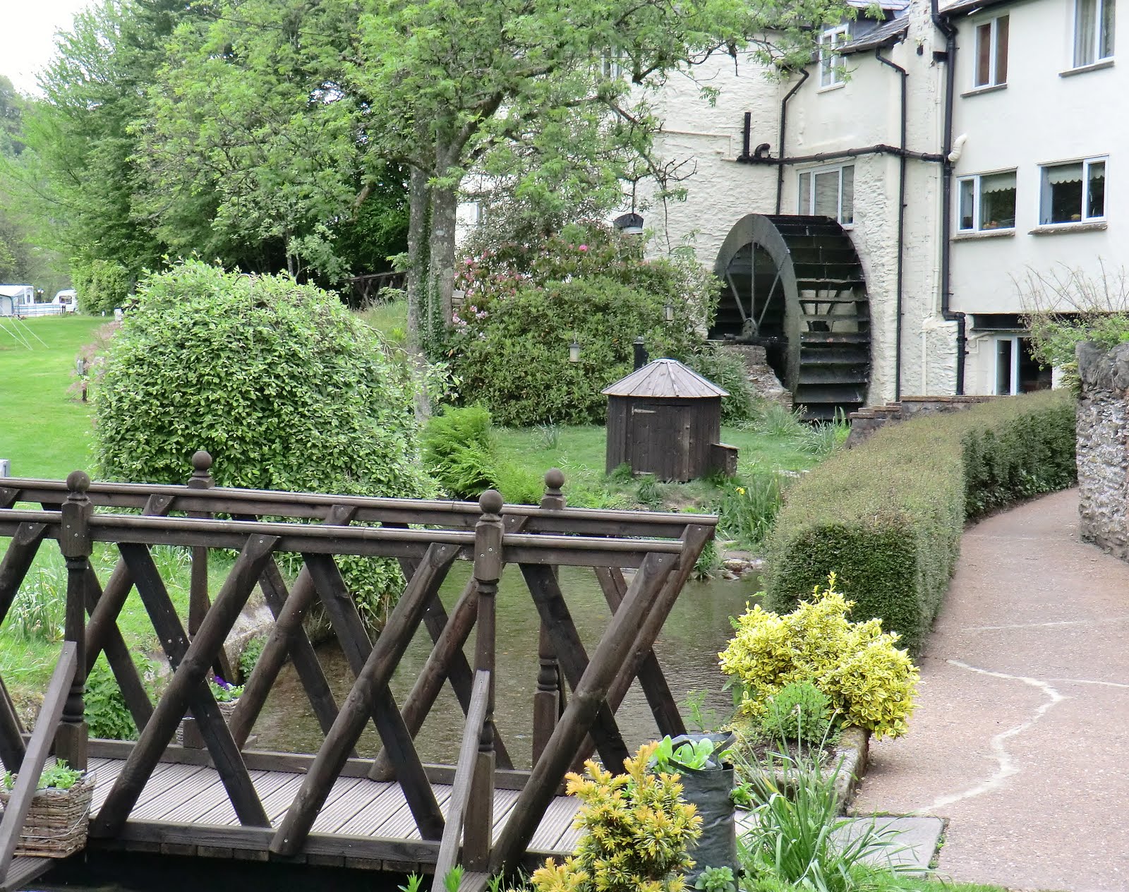 Bridgetown Mill
Built in the 17th century, this is Exmoor's largest mill. Last worked during World War II, its mill-stream & waterwheel are still noisily active! This is part of the Exe Valley Caravan Site, our van just out of the picture to the left

Long-suffering overhang on the narrow access lane to the site!
 Church of St Peter, Treborough
14th century listed building in a tiny village which once boasted 2 lime kilns & an enormous slate quarry
Like Bridgetown's mill it, too, was worked until the end of World War II

Followed the South-West Samaritans Way through part of Somerset & here it climbs up & down the Brendon Hills with knee-jarring frequency!
This is on the ridge above Leigh Barton
Wednesday 31st August
Day 17 auxiliaries!
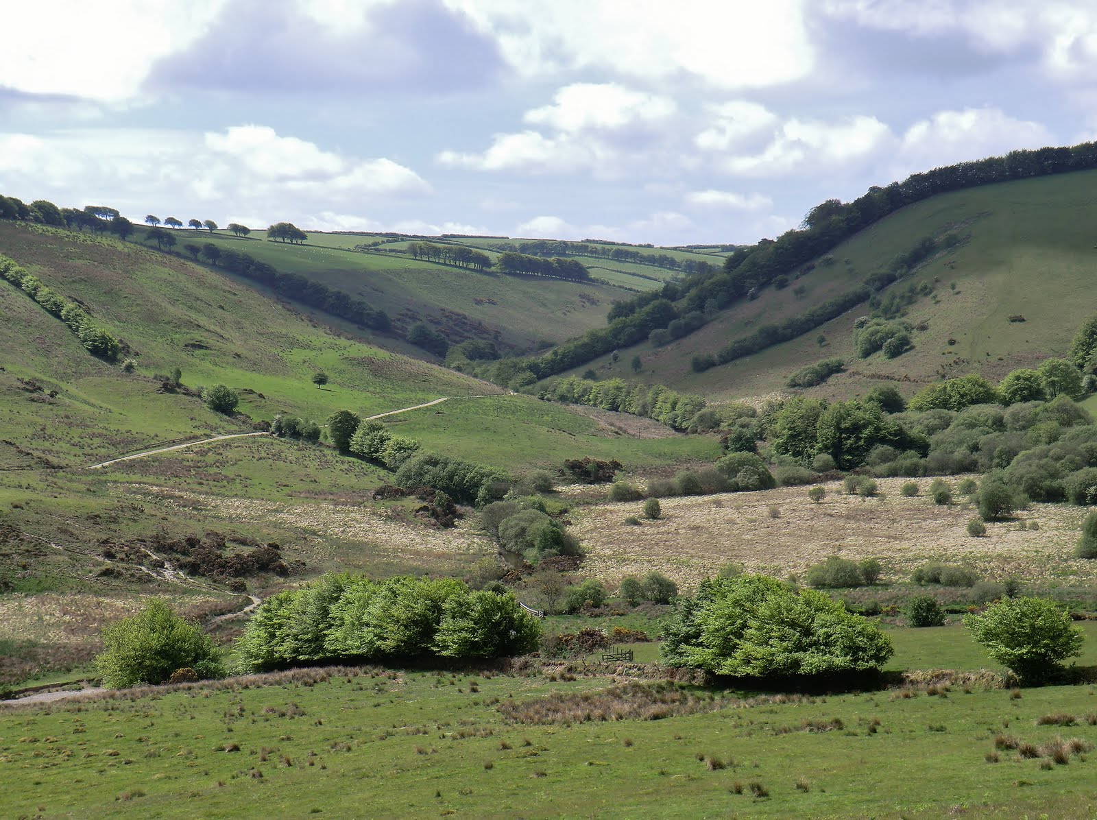

River Barle
Dating from the early 17th century, Landacre is the oldest arched-bridge on Exmoor. Excellent spot for a picnic but very quiet today... just a couple of dogs splashing about!

Excellent pubs with food at either end!

Outdoor wall painting in Winsford Village - curiously featuring on the toilet block in an area of children's playthings & attractive gardens! No information but I did wonder if it might be the work of Anna Fraser who has a studio here
Tuesday 30th August
Day 16 addendums!


Queen Anne's Walk, Barnstaple Clock Tower, Barnstaple
Built in 1713 as a merchants' exchange, Erected in 1862 as a memorial
Queen Anne used to overlook the to Prince Albert
port's fine Elizabethan quay which
proudly sent 5 of Devon's 6 ships to
face the Spanish Armada
 Didn't come across any real otters at all on the whole of LeJog so this one will have to do! 'The Tarka Trail' winds around North Devon in a figure of 8, crossing Exmoor, reaching Dartmoor near Bellever & twice passing through Barnstaple. Opened in 1992, I walked it a few years ago &, in some places, it is easy to recognise the settings for Tarka's adventures in the book!
 Church of St James, Swimbridge. Famous as the home of the 'terrier' vicar, Jack Russell!
Village of Brayford, on the edge of Exmoor - famous as the home of John Huxtable who designed & patented the Huxtable Plough in 1877. Modern ploughs look remarkably similar!
Monday 29th August
Day 15 cast-asides!

Another sculpture from 'The Still Point & the Dance' displayed on Richmond Dock, Appledore.
The work is by local artist, Sandy Brown, & has been exhibited throughout Europe

Old hulks near Northam Ship Yard, River Torridge

'The Kathleen & May', Bideford
Built in 1900 & named 'Lizzie May', the ship was bought by an Irishman who renamed it after his daughters
Carried cargo around the south-west under sail until as late as 1960

Looking across the Torridge from Instow to Appledore

Seat/Sculpture from 'The Tarka Trail', the old Bideford-Barnstaple railway line
Sunday 28th August
Day 14 outcasts!
 Buck's Mills
Remains of 'Old King Cole's' harbour, built in 1598. Limestone & coal were brought over from South Wales & burned in the kilns still visible below the village. Amazing number of rusted winches still standing on the narrow quay

Interesting functional sculpture above Peppercombe Beach!

Undulating low cliffs north-east of Peppercombe - brilliant walking!
Unsurprisingly, the hill is named Greencliff!

Appledore cottages looking out over the confluence of the Taw & Torridge estuaries....

.... and this their view across the Torridge to Instow
Saturday 27th August
Roy: many thanks for the donation - it's brilliant that you managed to keep up with us even without your own computer!
Day 13 cast-offs!

Mouth Mill Beach

Hartland Point
 Crazy Kate's Cottage, Clovelly
Once the home of Kate Lyall & her fisherman husband; she saw his boat capsize in a sudden squall just outside the harbour & watched as he drowned.
In 1736 she put on her wedding dress & walked into the sea here to join him

Clovelly Harbour & The Red Lion Hotel

Clovelly Bay & War Memorial Gardens from above the village
Friday 26th August
Trevor, Sam & Joe: many thanks for the donation & for the messages of support along the way - your comments helped me along when the gales were rattling about me & the next pub was half a day away! Good to see you at Alec yesterday, Trevor; all the best for the coming year!
Day 12 castaways!

Millennium memorial to Sir Goldsworthy Gurney who injected oxygen into an oil flame & then used mirrors to reflect the bright light & illuminate whole buildings!
An invention which he adapted to create more powerful, flashing beams in lighthouses

Bude Haven
&
Compass Point

Looking north towards Cleave Camp satellite-tracking station from Maer Cliff


Above: Speke's Mill Mouth & St Catherine's Tor
Right: Speke's Mill Mouth Waterfall

Hartland Quay
Thursday 25th August
Pam: as if looking after the house, worrying about the cars & tending the garden wasn't enough! Many thanks for the donation & here are a few more memories from Cornwall!
Day 11 Wannabees!


Bude Canal Sculpture - translated, this
means 'Barge Path'
 St Mary's Chapel, St Gennys Church, Crackington - War Memorial windows
Bude Canal

Another Bude Canal Sculpture
'If a man could have the strength of the sea he'd be a strong man'

Bude Haven & Crooklets
Beach

Sea Lock, Bude Canal
Wednesday 24th August
Julia: many thanks for the generous donation & the encouraging comments en route - pleased that we kept CJ & Maddie amused!
Day 10 also-rans!

Another triumph for Les!
View from the van at Trethevey. Next time we want to be where the white van is!


Boscastle Harbour

Coombe Barton Inn, Crackington Haven
Met our fellow 'Coast-to-Coasters', Wendy & Richard here. Another popular spot overlooking what is often a busy beach - again, very quiet for a Sunday lunchtime
Been here in all kinds of weather & at many different times of day & have always found it open - more than can be said for a lot of pubs on LeJog!
Tuesday 23rd August
Day 9 ne'er-do-wells!
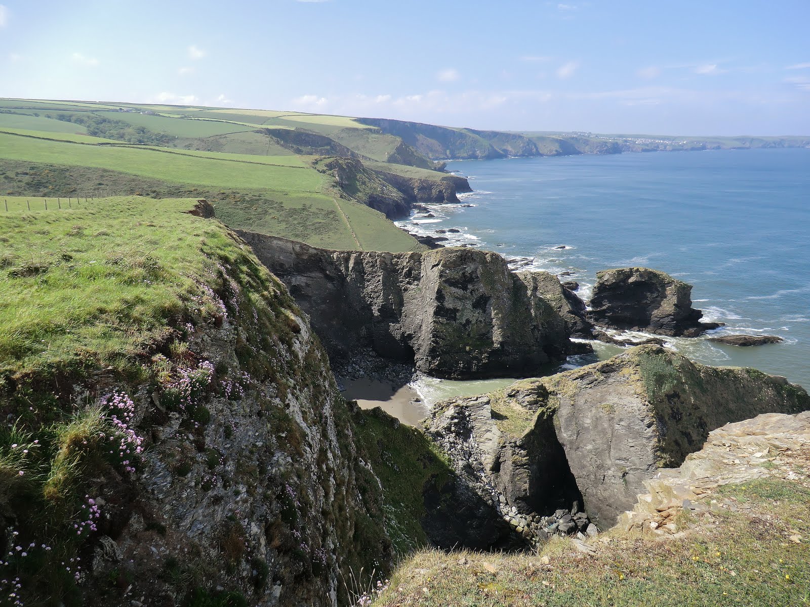
Looking back towards Port Isaac from Tregardock Cliff shortly after the early morning cloud & drizzle had cleared

Backways Cove - yet another descent & steep climb on one of the toughest sections of the whole LeJog

Port William Beach, Trebarwith Strand

'The Port William'
Excellent pub in a brilliant setting, overlooking Port William beach. I've never been here when it's been particularly busy but, apparently, it is very popular & can be packed!

Mouth of Rocky Valley, Bossiney Haven - just below our evening stopover at Trethevey
Monday 22nd August
Day 8 etceteras!

Similar to yesterday's view but a higher tide & taken from the northern side of the Camel

Daymer Bay, 'The Doom Bar' & Stepper Point - the Mouth of the Camel Estuary

Portquin - the last time I'd walked here the wind was gusting at 100 mph, the bay was full & the lane at the top of the beach awash. The village was being used as a film set & the makeshift wooden 'buildings' were in tatters.... much quieter today!

Port Isaac - 'The Golden Lion' is the white building in the centre, overlooking the beach. Met Les & we enjoyed an end-of-walk drink on their balcony

Tonight's view from the van!
Bodmin Moor from Rosebud Farm, St Teath.
Les did pick some good ones!
Sunday 21st August
Day 7 sedentaries!


Always take pictures of interesting Wooden collage-type sculpture in a
pub signs! Had a pint of 'Tinners' bird-hide on the Camel Trail
here in Padstow

Low Tide - looking across the Camel Estuary from Padstow to Rock

Camel Estuary from Padstow : the obelisk on Dennis Hill commemorates Queen Victoria's Golden Jubilee (1887) while the railway bridge across Little Petherick Creek used to carry sand inland &, later, slate & china clay to ships in Padstow harbour. Now, it's one of the most dangerous cycle-tracks I've ever walked!
Saturday 20th August
Mark & Family: really pleased I sent all those postcards - it amazes me how many people have been looking at them! Thank you, kindly, for the donation!
Stuart: OK - you can have an 'A' for reading the Blog so thoroughly! You've told me a couple of things about LeJog that I'd forgotten all about! Thanks for the donation!
Day 6 drop-outs!

Trevelgue Head (Porth) with Towan Head (Newquay) in distance

Tregurrian/Watergate Beach

Trenance Point

Pentire Steps
Friday 19th August
Andy: not sure what 'game' you lost by answering 'the Orkneys' instead of 'The Orkney Islands' but I hope it wasn't serious! I hope you argued.... I certainly would have done! When we were there the man in Kirkwall museum told me that while 'The Orkney Islands' is the correct modern name, historically the islands were invariably referred to as 'the Orkneys' but to use this nowadays winds up the locals!
I found the 'locals' always referred to each island by name, rarely used the title 'Orkney' & referred to Kirkwall's island as 'Mainland'.... which totally confused me!
37 not out wasn't too difficult but you're right - a good husband would take his wife on holiday now!
Trevor: thanks for your message about the JustGiving page - one or two other people have had problems with that as well & not even my super-efficient Technical Team have been able to resolve it!
Today's outtakes are from Day 5!

Perranporth Beach

'Old Albion Inn', 400-year-old pub in Crantock : Listed Building, fascinating interior & a very good pint of 'Doom Bar'!

Crossing 'The Gannel'

Sculpture above Newquay's Fistral Beach

Towan Head, Newquay
Thursday 18th August
Sorting through my hundreds of photos & adding captions, I discovered the pictures that 'disappeared' when the website 'crashed' on Day 12 were never restored.... despite their assurances! Mended that!
Moan from the manager: she points out that this is the first time she has seen some of these photos & hasn't a clue where some of these places are!!!! So, for Les' benefit, today's 'extras' are from Day 4!
This could run for ever!

Chapel Porth Beach, Wheal Coates Mine & St Agnes Head

Wheal Coates Engine House
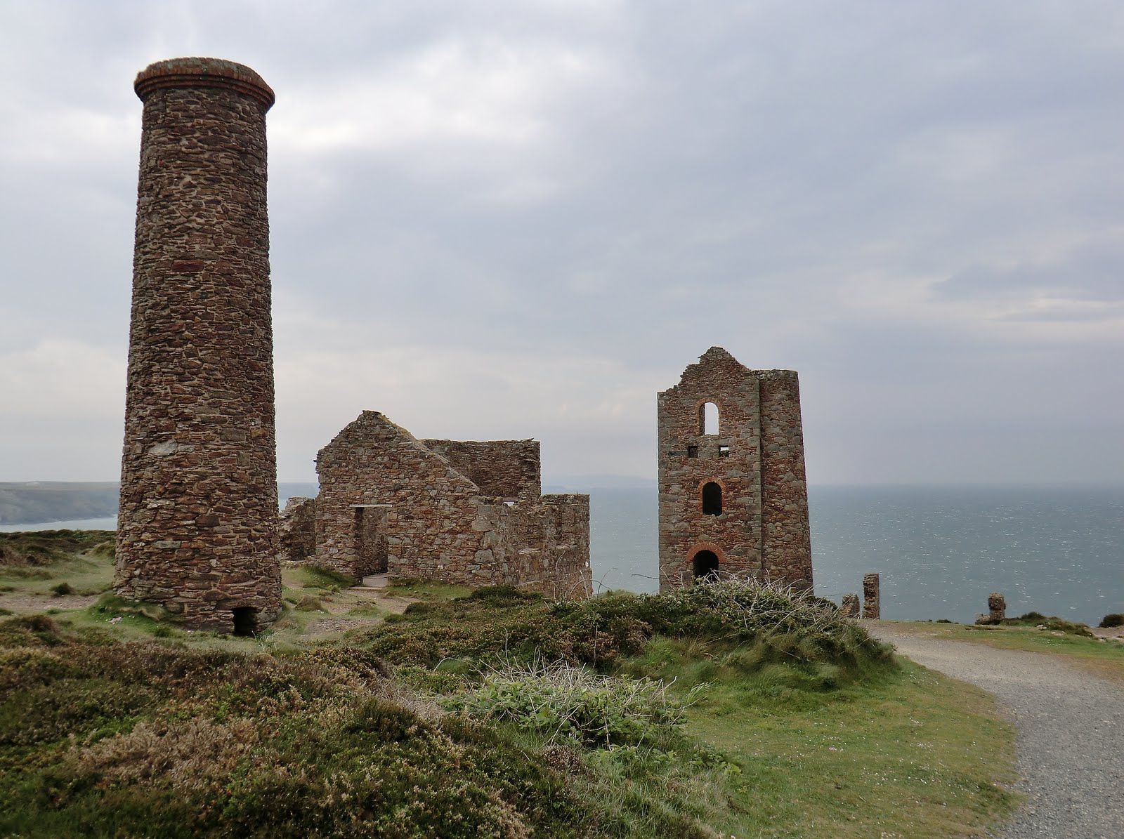
Wheal Coates Tin Mine Remains, St Agnes Beacon

Droskyn Castle, Perranporth - once a fine hotel, now apartments

Millennium Sundial, Droskyn Point, Perranporth
Curiously, this is set at 20 minutes ahead of GMT..... Cornish Time!
Wednesday 17th August
Maggie (a friend from Les' schooldays) & Adrian from 'The Swiss Bell':
Thanks to you both for your kind & generous donations!

Siege Mortar cast by Harvey & Co, a Hayle engineering firm, in 1856 to be employed in the Crimean War. This stands close to the site of their old foundry.

Unusual Pub Name & Sign, Phillack
One of the oldest buildings in the village, it's believed that it was called 'The New Inn' in the 14th century. Legend has it that the current name dates from the discovery of a mutilated body by the landlord in a well outside the pub!


Moving Memorial to a local Hayle man who lost
his life in the 9/11 attack
Tuesday 16th August
John the Carpet: thanks for the donation - much appreciated!
Wendy & Richard, Glen & David: lovely to receive your cards!

Gurnard's Head

Carving above entrance to 'Tinners Arms' pub in Zennor


The Mermaid's Chair, Zennor Church


Barbara Hepworth Sculpture Garden, St Ives
'Conversation with Magic Stones' (left) : 'Spring 1966' (right)
Monday 15th August
Trevor, Joe & Sam: thanks for the message - hope you had a great time in Normandy. A couple of days not walking & the knees are killing me.... I think the last thing I need is a rest! Went for a walk today!
See you on Results Day!

'First & Last' House, Land's End & Longships Lighthouse

St George & the Dragon - 13th century fresco, St Just Church

Levant Mine Engine House
Thanks to all those who have donated to the British Heart Foundation since I came home including: John, Norma, Kris & Melissa; Doreen & Scott; Mark.... & I still haven't met you!