Monday 7 July 2014

Postscripts from The Peak District (42) - Wildboarclough, Gradbach, Wincle

Tuesday 25th February 2014

Still in pursuit of Talwin, the first alien... & out walking on my own today!

Parked at the tiny village of Wildboarclough, wedged between one of the wilder stretches of the A54 & Shutlingsloe & Macc Forest to the north... a beautiful spot!

The rather dully-named Clough Brook runs through Wildboarclough.... but is probably more likely to have given its name to the village than any wild boar!

Lovely start but now a fierce climb up Berry Bank!

Had fun with a cache beneath a very low-level footbridge on this climb... I usually leave those for Les!

This is a view over to the hills I was walking with Les yesterday!

And there's Shutlingsloe again! Not on today's route but inhabited by another alien!


Passed an Ice Cream Farm (!) before crossing the high open moor & descending to the Youth Hostel, currently being refurbished, at Gradbach


From here I followed the River Dane, County boundary between Cheshire & Staffordshire, through lovely woodland & spectacular gorges back to Danebridge & Wincle!


A quick pint here at 'The Ship' in Wincle before picking up one cache I'd failed to find on the first day & then heading, via country lanes, back to Wildboarclough


A 'Ship' on the Staffordshire/Cheshire border?
Look at the sign!
This is Shackleton's 'Nimrod' on his first, less famous, visit to the Antarctic: Sir Philip Brocklehurst of nearby Swythamley Hall sailed with him as Assistant Geologist!

Sunday 6 July 2014

Postscripts from The Peak District (41) - Higher Sutton & Langley

Monday 24th February 2014

If I had to pinpoint a moment when the geocaching bug really bit me I'd have to say it was the day before this wonderful walk!

Two days ago a geocaching extravaganza had been published: seven interlinking walks with a total of 383 caches leading to one final super-bonus box! The theme was 'The Alien Landings' & the search was on to find the Black Box from their crashed 'Mothership'.... how could I not investigate when this was so close to home?!

I'd tackled my chosen first stage yesterday, walking out of Wincle (home of a fine micro-brewery), & was now back with Les to see how close we could get to securing our first alien!


A field-full of friendly alpacas, on our way south through rolling-farmland towards the A54

The 'Wild Boar' Inn on the main A54 road - didn't look too busy... and the pub wasn't open!


Took a bit of a detour 'to cut off a corner' & ended up wandering by some wonderful places!


Knew that, at some point, we were heading up to the top of that flat-topped hill.... but that was going to be a totally different alien!


Les below Shutlingsloe - wasn't going to be the last time I could say that!


A splendid diversion to Oakenclough &, at last, an open pub.... overlooking the route of our morning outward jaunt!


'The Hanging Gate'.... with a postal address of Langley though it's quite some distance & a good deal higher than the village itself!

Splendid spot & my 10th new pub of the year!


The fourth highest pub in England, it's been serving ale since 1621!


Don't know much about this outpost of Sutton Lane Ends but if the village sign is anything to go by it's the source of many of Shakespeare's plays... a lot of his plots were based on Hollinshead's Chronicles!

On our way down, now, to the muddiest of conclusions... but an excellent day, for all of that!

A geocaching 'trackable', whose owner had wanted it to be left in places with interesting names... I had been aiming for 'Hanging Gate' but that looked a little vulnerable: left it a little lower midst Pot Lords, Fernlee & Lowerhouse!

Friday 4 July 2014

Postscripts from The Peak District (40) - Tissington Trail, Hartington

Friday 21st February 2014

A brief geocaching jaunt with Les, Jamie, Kirstie & Abner &, as you can probably see from the photos, it was bitterly cold.... but beautiful! (see Postscripts 31 & 34)

Parked at the old Hartington railway station & wandered along the Tissington Trail, former Ashbourne to Buxton railway line
Finishing off a geocaching series involving Tissy & Parsley.... a pair of mice!

Waste heaps created from the stone cut in the construction of the railway at the end of the 19th century

Short walk today as Abner wasn't very well & the wind was taking no prisoners!

Postscripts from The Peak District (39) - Cheddleton

Thursday 20th February 2014

A lunchtime geocaching meander around the grounds of the old St.Edward's Psychiatric Hospital... now a new housing development incorporating some of the old hospital buildings (see, also, Postscripts 5 & 20)


Also known as the Cheddleton County Mental Asylum, the hospital opened in 1899 & was finally closed to patients in 2002


The Asylum Chapel, a listed building but looking rather run-down & neglected
Home, however, to an intriguing geocache!


... and this is it!
A hidden camera masquerading as a letterbox had my picture published on the internet even before I got home!

Postscripts from The Peak District (38) - Rolleston-on-Dove

Wednesday 19th February 2014

I've finally accepted that there's no way I'm going to keep up-to-date wih this blog while I have walking, geocaching & visiting pubs to do (not necessarily in that order!) &, by the time I retire from all of that, I probably won't be doing anything worth writing about!

So, photos & brief captions.... for the time being!


A morning's geocaching in Rolleston before the rest of the crew took themselves off for 'afternoon tea' at some posh place just outside the village!


Though they weren't too posh to drop in to 'The Jinnie Inn' with me!
Named after the railway that ran through the village until 1968, it was on the old Tutbury to Burton-on-Trent line
We'd geocached on 'The Jinnie Trail', a nature-walk along the old track-bed

My 9th new pub of 2014!


Rolleston was once best known as the home of Oswald Moseley but his Rolleston Hall burned down many years ago


Lee finds a tractor to play on in a rather muddy picnic area!

Monday 3 March 2014

Postscripts from The Peak District (37) - Shropshire Union Canal, Chester

Tuesday 18th February 2014

OK, so to adopt Chester as part of the Peak District might be a little presumptuous but it was only a half-term holiday day-trip & I did give it all back at the end of the day!

Les, Jamie, Kirstie, Lee, Andy & Abner all spent the day taking in the city sights but I set out from Cheshire Oaks Shopping Outlet & geocached my way down the Shropshire Union canal as far as Chester Canal Basin!

Probably the only visitor to Cheshire Oaks never to even venture into a shop!

The M53, the M56 & the North Cheshire way all meet up above the Shropshire Union at a tiny village called Stoak.... wasn't very busy at all!
The footpath runs for 70 miles & links The Wirral Way with The Gritstone Trail at Disley


Opened in September 2006, its creator did not live to see its completion - this memorial is beside Cloughton Bridge

The motorways are really just part of a giant outer ring-road for Chester!


Very colourful stretch through the moorings between Cloughton & Caughall Bridges
Some of these are obviously lived-in - others looked as if they were enjoying their first visit in a few weeks after the prolonged wet weather

This apparently quiet section is only a few hundred yards away from the busy A41

Never really escaped from the sound of cars, trains or aeroplanes today... but the walking was quite tranquil!


Could write loads about the link with , Chirk & Llanymynech from LeJog, the Ellesmere, the Trent & Mersey.... but I'll save it for a more political rather than pleasurable visit!


Modern bridges & new flats beside the old entrance to Chester Canal Basin


I'd not heard of Rolt before finding this plaque - I've ordered his 'Narrow Boat' book about his travels aboard 'Cressy' immediately pre-World War II. From what I've read I think I'll find it interesting but don't expect to like him too much - I'll keep you posted!


... and these are just a few of the beautiful old working buildings around the Basin!
I'd done the walls, the castle  & the Roodee before - this was a first!
Oh Dear, industrial archaeology again!

Saturday 22 February 2014

Postscripts from The Peak District (36) - Matlock

Thursday 13th February 2014

Les & Jamie had booked into Cafe Central in Matlock to learn how to make macarons so I was given the honour of looking after Abner for the afternoon!

The plan had been to do a little geocaching while I was waiting for them to arrive, then take Abner for a walk in the pushchair while he went to sleep (a couple of times round the Park), finishing off in Wetherspoon's while we waited for their cakes to cool!

Didn't quite work out according to plan as Abner wasn't interested in sleeping & then wasn't very well.... so we spent a lot of time cuddling & never made it to the pub.... & Abner likes pubs!


This is part of the colossal Cawdor Quarry which finally closed in the late 1990s but which still dominates this part of Matlock


Despite the above date I found references to it being used as a public tip 'for the last 50 years' & a local rock-climbing club refer to trees showing 'at least 40 years growth'!
The land was originally bought by Sainsburys & there's a new store & petrol station here: it was then sold on for housing & new homes stand all along the top of the quarry-edge!
Views are impressive from here - they must be fantastic from up there!

Monday 17 February 2014

Postscripts from The Peak District (35) - Barlaston, Wedgwood, Trentham, Meaford

Monday 10th February 2014

Dubious forecast & I did get a bit of a soaking half-way through the day.... but I do have itchy feet if I don't fit any walking in for a few days!

The plan was to capture the Staffordshire LQ geocache sited on the outskirts of Stoke, at Trentham (see Postscript 32)

No intention of driving there, though, when there's a perfectly good canal I could stroll beside! Took the strolling a little too seriously on my return journey & wandered as far as the edge of Stone!

Parked beside Downs Banks Brook at Wash Dale & wandered upstream before climbing the western Downs with this view across the valley
Potential for superb views all round but rapidly disappearing in rain clouds!
Brindley's canal runs from the Mersey, near Runcorn, to the Trent, near Shardlow &, while I have walked several sections before, this would be the closest to home!
He had already completed one major canal for the Duke of Bridgewater, finished in 1759, when Josiah Wedgwood approached him with the commission for what became 'The Grand Trunk Canal'!

I'd walked through Barlaston & passed the old Wedgwood factory by the time I arrived at the first acknowledgement of The Potteries, close to Trentham Lock

Lots of interesting plaques beside the canal offering a variety of information & most of them, thankfully, are graffiti-free

Included this photo to show just how 'close' to home it is & to show how our local Caldon Canal fits into the scheme of things

You may have to click on the image to read the small-print but Leek & Ipstones are just beyond where the blue stops (top right)!

If you're looking for the bit I'm walking here..... I've just squeezed on to the bottom of the map!
Walked about as far as the yellow 'Museums' dot to secure the 'Ancient Oasis' geocache, nestled in Hem Heath Woods, before heading back to Barlaston & New Pub No.8, 'The Plume of Feathers'!


Friendly people & fine cider but rather bare & cold inside... lacked atmosphere
Nevertheless, comfortably ahead of schedule now!


Best canal-walking of the day, however, was the stretch south of Barlaston
The above photo was taken just beyond a row of cottages & beside a huge carved stone announcing Barlaston Boatyard
Further along I passed through the old site of Meaford 'A' power station where huge cooling-towers once stood..... they were demolished in 1982 but nature seems to have won this particular battle without a great deal of apparent effort!

Meaford Locks
Far enough for me today! If I didn't turn around now I wouldn't get back to the van before dark!
Besides, around the corner at the bottom of this flight & I'd be in Stonefield, a suburb of Stone!

Postscripts from The Peak District (34) - Tissington Trail : Alsop-en-le-Dale

Friday 7th February 2014

Good weather forecast & Jamie was keen to get out walking with Abner.... so it was back to the push-chair friendly firmness of the Tissington Trail, a little to the south of last week's snowy outing! (Postscript 31)

Had been geocaching our way northwards from Ashbourne, collecting 'The Tissington Tales' series of caches with Jamie & Abner, since before Christmas but some of those outings are still waiting to be featured in 'Catch-Up' blogs!

'The Tissington Tales' tell of Tissy, a mouse, making her way along the trail to meet her friend, Parsley! Have a feeling I'll have to do this again with Abner when he's old enough to understand the story!

I'd had to pop into Cheadle first so drove out to Alsop in the van while Les went in the car to pick up Jamie & Abner
Aiming to meet in the Tissington Trail car-park but I was a bit early so nipped down to the village for a nearby cache!


Ridiculously muddy & slippery on the way down so I retuned up the lane & walked back along the railway to meet them!
Cracking views today This is looking west towards Narrowdale & Wetton Hills


Alsop Moor Brick & Lime Works Quarry which closed shortly after World War II & is now home to a Camping & Caravanning Site!
Those dark clouds brought a brief & totally unnecessary hail shower!


..... though still lovely to the West!

There's a quick route down to Dovedale below those trees but I imagine it might be a bit too quick in these wet conditions!
Surprised to discover I don't already have a photo of this stashed away somewhere!
Recycled from old railway bits - even the low wall was part of an old track-side building!

Successfully geocached along to the edge of Biggin Moor, though one of the earliest had disappeared in an apparent cull of over-hanging trees, before deciding it was close enough to Abner's lunchtime to warrant a turnaround!
Above photo taken looking west from near Coldeaton


Almost back to the start & this is the bank that I'd slithered down to reach the tiny Alsop-en-le-Dale.... not sure I'd do it again!

Lovely, sunny end to the day at the 'Coach & Horses', Fenny Bentley
New Pub No.7!

Built in the 16th century as a box-framed half-timbered house, it became an inn about 1760

Enjoyed a good pint of Abbeydale's 'Moonshine' - apparently the brewery's best-selling beer though I hadn't come across it before!

4.3%, a pale bitter, it was Yorkshire's Champion Beer in 2012!

Friday 14 February 2014

On Tour! - Lincolnshire (1) : Fiskerton

Thursday 6th February 2014

Diane's birthday (my sister) on Friday so popped over to Lincoln to go out for lunch with her - returned late afternoon when a boat may have been more use on the Belper-Ashbourne road!

Couldn't resist nipping out to Lincolnshire's 'Little Quest' geocache (see Postscript 32), only a few miles along the River Witham from her home!

All of which led me to collecting New Pub No.6, slightly ahead of schedule!


Never been to Fiskerton before so lucky to stumble across such an excellent pub!
Food very good & I enjoyed a couple of pints of Belhaven's 'Grand Slam' - very drinkable! Bit sad that the carpenter seems to prefer tea!


The river makes its quite regulated way through a flat landscape all the way to Boston & The Wash, an area I've walked more often than this.... but which looks to be worthy of further geocache exploration!

A bit of exploration a little further afield may also be in order. Fiskerton was the site of an Iron Age settlement, as evidenced by several archaeological digs: the 'Witham Shield' can be seen in the British Museum while 2 boats & a variety of weaponry are on display in Lincoln, found beside the 2500 year old remains of a wooden causeway. Seems these modern methods of land management might not be as modern as we think....!

Postscripts from The Peak District (33) - Long Rake, Monyash, Lathkilldale, Over Haddon

Monday 3rd February 2014

Out walking 2 days in a row - now there's a treat! Very windy & cold on top of the moor but positively balmy in the shelter of Lathkilldale!

Another geocaching venture & this, in part, was to finish off bits I'd intended to do last week from the Tissington Trail (Postscript 31) before snow drove me home early

The other part was to visit the source of the River Lathkill before the waters subsided (more on that in a moment), but while the rest of the Dale was walkable.... after 2 dry days I thought that might be possible!


Parked at Parsley Hay again & walked along the Long Rake road towards the quarries passing, en route, the site of Arbor Low stone circle - no time for a closer inspection today!


I'd picked up a couple of 'Sites of Meaning' (S.O.M.) caches whilst walking out this way before & was interested to find more


Carved marker-stones were placed at the 17 possible entry points to the Middleton & Smerrill Parish as a millennium project
This one bears the inscription:
Time, you old gipsy man;
Will you not stay;
Put up your caravan;
Just for one day?
: taken from a Ralph Hodgson poem & suggested by a local man, one of whose grandfathers farmed Arbor Low while the other was station-master at Parsley Hay. In his childhood there was a small quarry here & a gipsy caravan would visit each year, parking in the quarry


Part of the Long Rake inscription which reads:
A dull sky, Feel the cold.
Touch the snow, A lonely landscape.
Hear the wind, See the hills.
It’s freezing cold, And empty

:written by 2 children from Youlgrave Primary School after a visit to the project


'The rakes and spoils of man’s hard toil, has shaped this land'
: composed by ladies who work for the quarry company just across the road from this stone set into the ground beside a stile


Last one of my first 'walk of the day' reads:

'Bright Under Green Limestone Edges. With Queen Ann Lace
and Cranesbill in her Hedges'


:this uses the initial letters of the Parish's newsletter 'Bugle', whose editor sponsored the stone

Off to Monyash where the wind was wild!

Came to look at the old village Pinfold which I'd never noticed before & then  wandered along The Limestone Way to the top of the moor


Returned to the village to pick up clues for a multi-cache which, it turned out, was on my afternoon route!


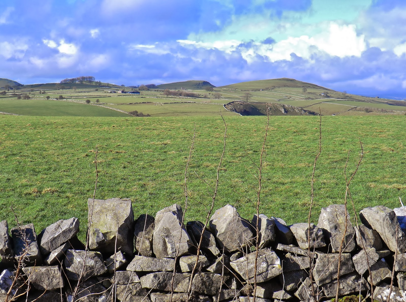
This is Upper Lathkilldale, easily accessible & less than a mile east of Monyash - from here, southwards, is one of my favourite bits of the whole Peak District!


Hadn't walked the length of Lathkilldale (Postscript 10) since Easter 2008 when I walked the Peak District Inn Way.... & I need to do that again!


The waters of the River Lathkill drain from Flagg Moor, just to the north of Monyash, but this is the first point at which they can be seen - flowing from Lathkill House Cave.... & this is what I'd come to see!

I've walked here in Winter before, in 2008 it was after a reasonably heavy snowfall, but I've never seen as much as a trickle! Like the Manifold (Postscripts 2 & 27), it happily flows underground through the limestone & often doesn't 'rise' until half a mile or more down the valley!
This, though, was quite spectacular & did make me wonder if I'd be able to walk the whole of the Dale!


One possible escape route! Over the splashily accessible footbridge & up through Cales Dale back to Monyash!


Climbed to the upper reaches of the Dale, that's where my mystery multi-cache was hidden, before returning to the Lathkill!


Further downstream the river widened to almost fill the valley-floor in places but there was no way I was going to turn back now!

Remains of the Mandale Mine, one of several very profitable lead enterprises in the Dale
This closed in 1851 after years of flooding problems! An old aqueduct & traces of various leats can still be clearly seen


Beyond the old mill below Over Haddon the valley is wider, the river gentler & the path easy to walk
I carried on to the medieval Conksbury Bridge before taking to the road for my rather lengthy walk back to Monyash.....