Friday 9 October 2020

'Ip 'Ip LeJog : Day 7 - Alton to Rocester (Day 2 South)

A fine morning but with heavy rain forecast for the afternoon we decided to slot in this comparatively short stretch, via Denstone, & see if we could beat the weather!

It all worked out perfectly! The later photos show the fine sunshine in Rocester when we finished. Dark clouds were rumbling towards Alton when we picked up the van &, thirty minutes later, upon reaching home, Ipstones was awash! Five minutes after this & it had eased enough for me to wander down to 'The Marquis of Granby' for a pint & to order Friday night fish & chips!

Sadly, the mileages went a little awry as we continued in a south-easterly direction still following The Churnet Way & bits of The Staffordshire Way - finished further away from both Land's End & John O' Groats!


 Started off by picking up a nearby Church Micro geocache left over from the other day before the promised closer look at Alton Castle.
Pugin's castle is the third to occupy this hill-top site with its commanding view over the Churnet Valley.
The first was an 8th century Anglo-Saxon fortification while the remains of the second can be seen on the left of the photo. This was built in the 12th century & was typically Norman with several towers linked by curtain walls.
The castle came into the possession of the Earls of Shrewsbury through marriage in the early 15th century but, unfortunately, they backed the wrong side in the Civil War & Cromwell made sure it could no longer operate as an effective stronghold!


And so to the 16th Earl who commissioned Pugin to demolish the old castle & create a "new building which was designed to look like a medieval castle built by English crusaders of the Knights of the Teutonic Order in Germany."
Pugin was already working on Alton Towers, the Earl's family-home, so this seems like a bit of an elaborate folly!
The castle has spent much of its working-life as convent, boarding-school, Catholic Youth Retreat & wedding-venue... at the moment it just looks a bit neglected.


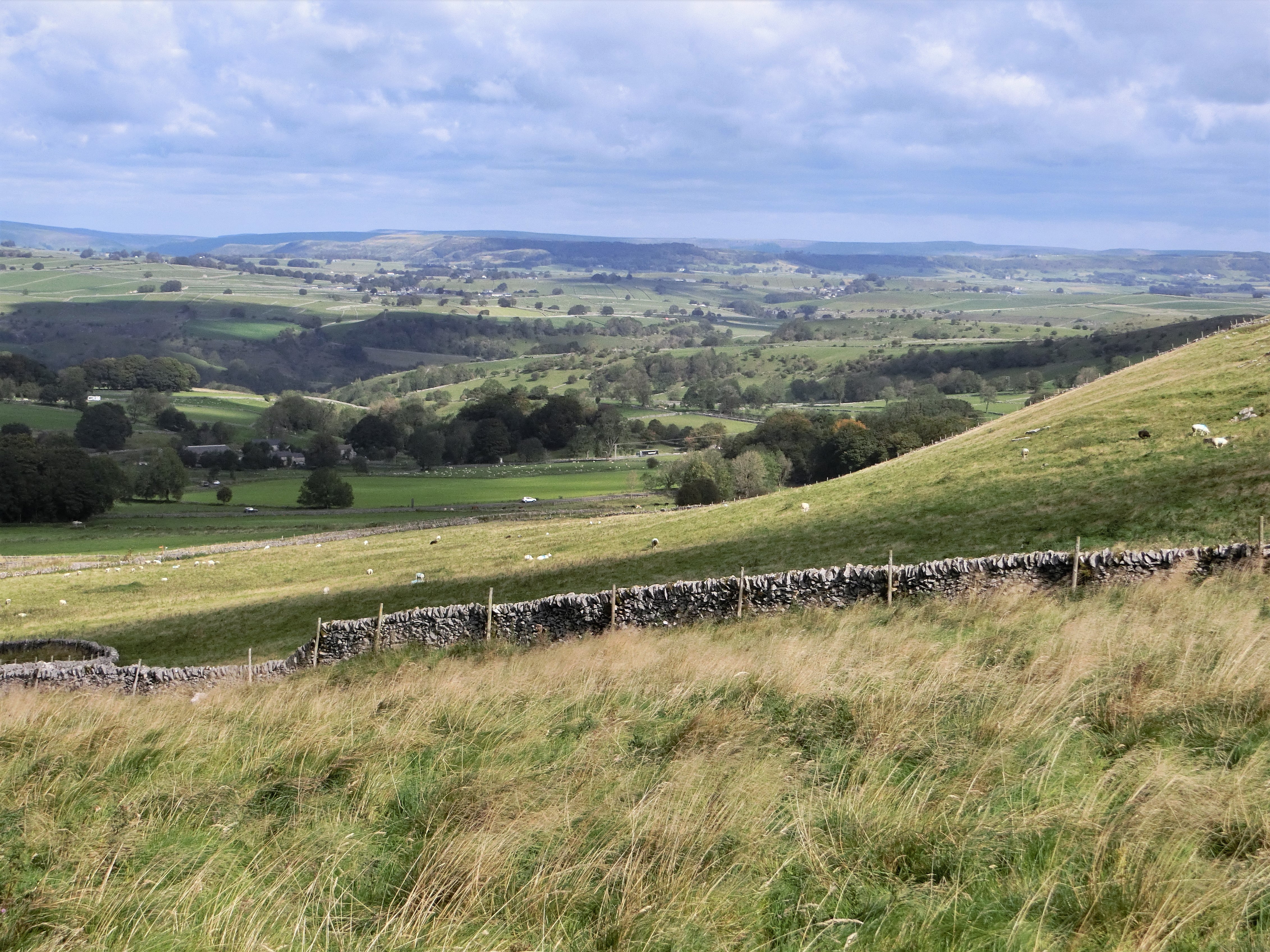
The Staffordshire Way again chooses the high ground out of Alton, along an old saltway unimaginatively named Saltersford Lane but we took the lower route purely to take this photo!
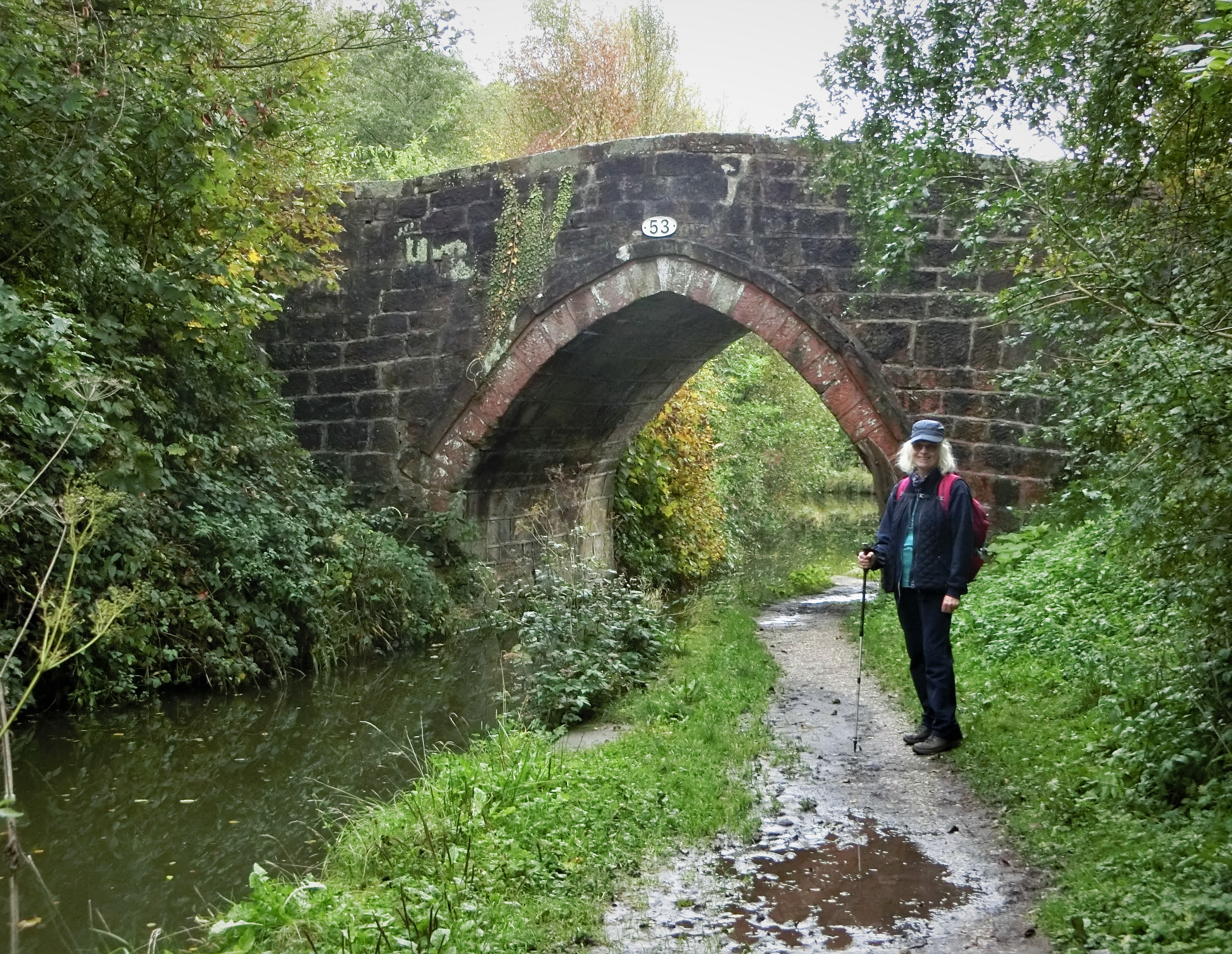
In 2014 replacement mileposts were cast to mark the original route of the Uttoxeter Canal (see Day 6) & I love that these replicas stand alongside the cycle-track/footpath & former railway!


Denstone Station
Just about as far as you can follow the old railway & canal route.
Originally there was no station here but this was built when Denstone College opened in 1873 as a Christian boarding-school for boys.
Nothing at the station now except sheltered picnic tables & a few children's playthings provided by Burton Breweries.


Memorial Fountain, Denstone
Erected in 1900 to the memory of Sir Thomas Percival Heywood, a Manchester banker who moved to the area in 1846 - an area known, locally, as Denstone-in-the-Dirt!
He set about developing the village & creating a Parish. All Saints' Church was opened in 1862, the village school in 1870 whilst he was also co-founder of Denstone College with Nathaniel Woodward.
The fountain is still fed by a spring & reservoir which, originally, also provided piped water to roadside taps & to some of the houses in the village.


Sir Thomas' Village school was eventually replaced by All Saints First School in 1998 & we passed it just a little further along Oak Road.
Love the Covid posters on their gates!


"... a creature with terrible claws, and terrible tusks in its terrible jaws, and knobbly knees and turned-out toes, and a poisonous wart at the end of its nose."
Thanks, Julia Donaldson - what else can I say?!


 This is mostly why we ran out of canal, railway & cycle-track! JCB World Headquarters!
Founded by Joseph Cyril Bamford in 1945, he began his business in a rented lock-up garage in Uttoxeter.
According to the company, they currently "have 22 plants on four continents and more than 750 dealers around the world."


Startled Horse by Mark Delf
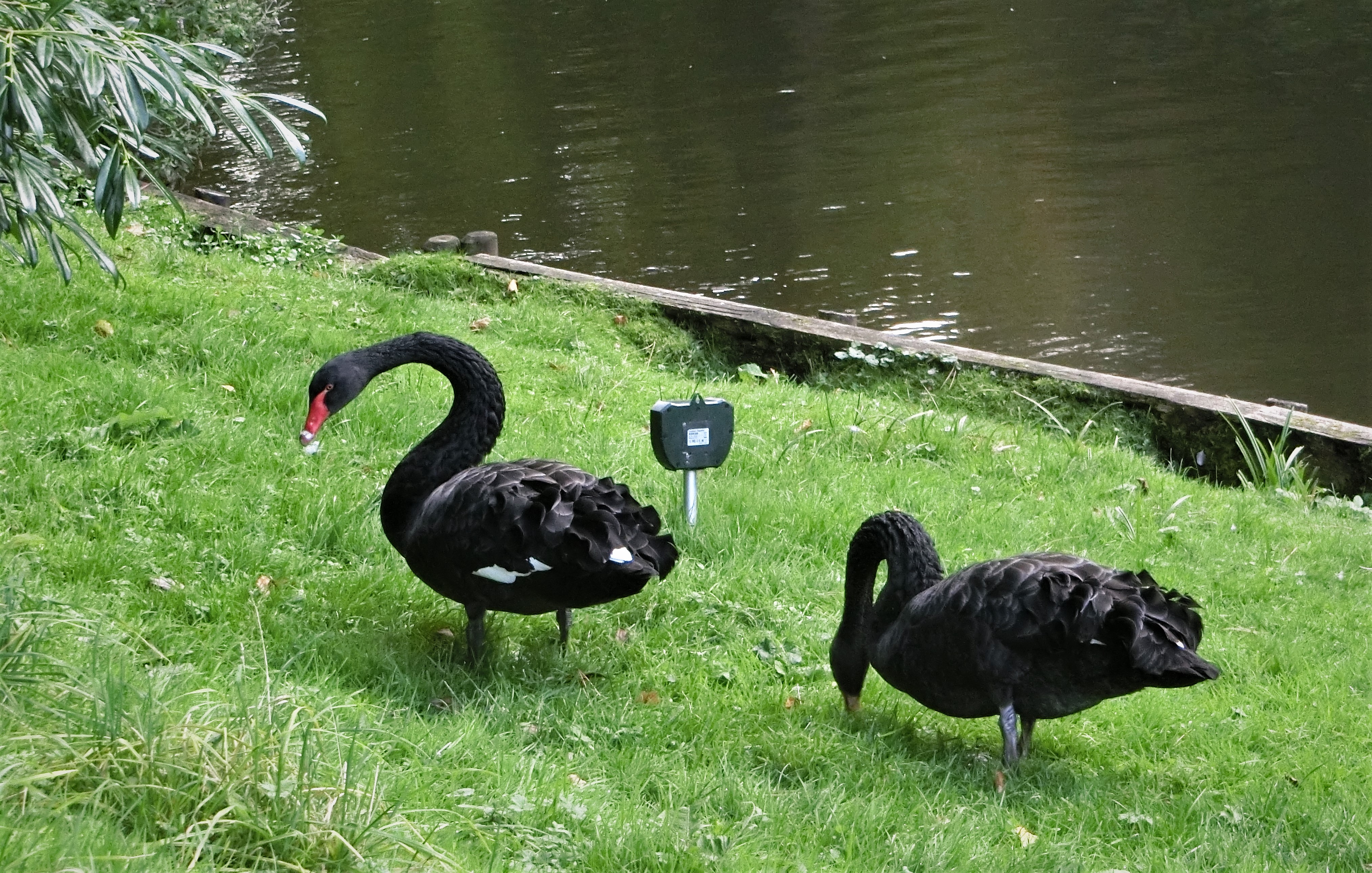
Finished today's walk with a wander around the JCB Lake, certainly my favourite thing about the site!
A variety of interesting sculptures, this one by a Staffordshire artist.


Sumo by Allen Jones
Managed to find our second cache of the day here!


And, finally, Opus : another by Mark Delf
I presume Lord Bamford likes this one as his machinery makes this kind of work so much easier!

Time to head over the road & into the village of Rocester...

Today's distance : 5.88 miles        9.46 kilometres

Cumulative : 61.11 miles        98.36 kilometres

Direction of Travel : South-East!

Progress : We are now 396.76 miles from John o' Groats (+1.87 miles)!
& 260.19 miles from Land's End (+0.17 miles)!


Wednesday 7 October 2020

'Ip 'Ip LeJog : Day 6 - Ipstones to Alton (Day 1 South)

Wet for most of the last week &, with no reason to venture out in such weather, this was our first excursion for a while! Totally different from LeJog in 2011 when I felt obliged to walk every day &, indeed, we had a deadline day to finish!

With Kirstie keen to walk the next leg northwards with us it was time to turn our attention to a southern route - no easy task! First thoughts had been to head across to The Trent & Mersey Canal at Barlaston & follow that towards Stafford which would have taken us along a lot of minor roads & previously-walked paths... as well as skirting Stoke, where increased restrictions were being discussed.

Finally opted for The Staffordshire & Churnet Ways, today taking us to Alton via Consall & Froghall... albeit in a south-easterly direction!


Chapel House, Belmont, Ipstones
A longer walk on the cards today so, no messing about! Straight across the fields from home heading for the Caldon Canal & both the footpaths we were to follow!
Chapel House is something of an anomaly in that it was built by John Sneyd of Belmont Hall whilst he was, allegedly, at odds with the vicar of St Leonard's in Ipstones, William Carlisle. Yet at the same time he & his family were paying for the rebuilding of St Leonard's!
Whatever the argument, Sneyd & the vicar made it up & this 'alternative' church was never used other than as a house... although a 'local' tells me there was once a nunnery here...


... & why the South African name? Sneyd's next-door neighbour at Belmont Farm was the same William Carlisle & his son was, in 1820, to emigrate to South Africa.
To complicate matters still further, when Carlisle died in 1833 Sneyd became the 'new' vicar at St Leonard's - a post he held for a further 28 years.
All very curious!


The Devil's Staircase wends its way down to Consall Forge in the Churnet Valley from beside Belmont Hall. These crumbling concrete steps replaced their well-worn stone predecessors which, presumably, took workers down to the forge, the mills & the lime-kilns that once littered the banks of the Caldon Canal. Devil's Staircase indeed...!


There haven't been many pub stops on this expedition... unlike last time around when I visited 200 different establishments!
This one is close to home & one of my favourites. They opened just as we were passing their door so we couldn't really not stop! Just as well we did as it rained quite heavily & we were able to shelter in their marquee!


'nuff said! We didn't find him!


Consall Station
Almost opposite the Black Lion pub &, interestingly, only opened in 1902 when much of the area's industrial activity had sharply declined & the railway was looking to develop tourism! The line itself had opened in 1849.
I love the way that the platform hangs over the canal to squeeze the railway between canal & river!


Canal, river & railway just a hundred metres or so south of the station!
For almost a mile before the Black Lion river & canal run together as the valley is too narrow to accommodate both!


Changeover Bridge, Caldon Canal
So, back to James Brindley (see Day 5!). As a branch of The Trent & Mersey this route was surveyed by Brindley but wasn't completed until six years after his death.
The Changeover Bridge was built by North Staffordshire Railway in the late 1840s, switching the towpath to the opposite bank to give them room to construct their Churnet Valley line.
The bridge was built from old rails!


Cherry Eye Bridge
Although the canal was built, primarily, to carry limestone quarried at Caldon Low (see Day 1!) & transported to Froghall via inclined tramways it also supported countless mines, kilns & other industries clustered along the valley.
Cherry Eye ironstone mine was the last of them to close & was situated just above this bridge - it took its name from the redness of the ore to be seen around the eyes of the miners, just like the blackness around coal-miners' eyes.


Site of Thomas Bolton Copperworks, Froghall
All that remains of the once-proud, world-famous copper-producing company. They manufactured the first trans-Atlantic telegraph cables just along the railway at Oakamoor, opened this site in 1892 & provided the cabling for the Beijing Olympic Games as recently as 2008.
The site now houses Agility Defense & Government Services (not a spelling error!) which seems to involve a lot of military stuff!


Abandoned The Staffordshire Way just before Bolton's but continued along The Churnet Way, a 30-mile footpath from the river's source below The Roaches to the River Dove south of Rocester.


According to an Environment Agency report in 2006 the Churnet was once, probably, the most polluted river in Europe - hardly surprising given the history we'd just walked through!
A very different river these days... though heavy rain still leads to frequent flooding!


The Staffordshire Way rejoined us close to this point having taken an unreasonably steep diversion through the village of Kingsley Holt!
Just beyond the second field here is an embankment on the left which, over 200 years ago, was the base for the tramway that carried coal from the Cheadle collieries to a canal wharf... long before the railway was even thought of!


East Wall Farm, Hawksmoor
Impressive farm buildings dating from the 1850s & unchanged since then... so, comparatively modern for around here!
Before that the site was occupied by miners' & canal workers' cottages that disappeared soon after the closure of the East Wall colliery &, in 1846, the closure of the canal.
Even before that this was the site of a medieval iron forge... now it's all National Trust territory!


Ousal Dale
These fine black swans now occupy the area that once belonged to Alton smelting mill. Built in 1741 to smelt lead ore brought in from Ecton in the Manifold Valley (see Day 2!), the site comprised "a certain smelting mill, refinery, slag hearth, smith's shop, two houses, a barn & about nine acres of land lying near the same with a pool of water."
Some 45 years later the smelting mill had become a corn-grinding mill where a 20 foot water-wheel drove three pairs of stones!


Back to The Churnet Way for the last stretch of today's walk to Alton... but felt guilty I didn't have a Staffordshire Way sign photo so here's Eeyore outside the Rambler's Retreat, a popular 'Country Tearoom'!


Canal, railway, cycle-track or footpath? OK - all of them!
The Froghall - Uttoxeter canal was started in 1807 but not completed until 1811: it carried little traffic & consistently lost money. Useful for the Boltons in Oakamoor, the collieries in Cheadle & for shipping limestone south from Caldon Low to the kilns at Alton, Rocester & Uttoxeter... but none of that would make it profitable.
When the North Staffordshire Railway took over The Trent & Mersey Company its days were numbered... but not before transporting all the necessary railway construction equipment!
The railway lasted rather longer, being closed in stages between 1964 & 1988.


Alton Station
Quite a grand building for an industrial railway station & now available to rent as a holiday cottage!
Obviously, more to this than meets the eye & that's down to the Earl of Shrewsbury & the nearby Alton Castle & Alton Towers! The station was built to impress guests & visitors to the 19th Earl's family home... along with a luggage lift to transport baggage directly up to the Towers!
In 1954 the station was renamed Alton Towers but reverted to its former name 25 years later... just before Alton Towers opened as a Theme Park!
There is still talk of reopening the railway to bring visitors to the valley & to the Park...


Alton Castle
This is the mid-19th century Gothic-revival castle built by the 16th Earl's famous architect, Augustus Pugin.
More about this when we get a little closer at the start of our next walk!


The Talbot, Alton
There's been a shortage of pub stops on this expedition so far so I don't feel guilty about two in one day... particularly given the weather!
This is one of the oldest buildings in the village, appearing on a map of Alton in 1775. Talbot was the family name of the Earls of Shrewsbury so this could well have been named after the 14th Earl, George!
A more famous 'Talbot' was probably Charles Henry John, the 20th Earl, who founded Talbot Cars in 1902!


Finished our day by walking up through the village & past this impressive old lock-up. Built in 1819, I'm sure it's held many a drunk over the years...!

Today's distance : 11.20 miles        18.02 kilometres

Cumulative : 55.23 miles        88.90 kilometres

Direction of Travel : South-East!

Progress : We are now 394.89 miles from John o' Groats (+5.34miles)!
& 260.02 miles from Land's End (-1.67miles)!

Monday 28 September 2020

'Ip 'Ip LeJog : Day 5 - Topley Pike to Rushup Edge

A brilliant day's weather for the latest leg of our jaunt - the winds had finally abated & we were down to shirtsleeves soon after climbing out of Chee Dale!

I had said that we could stick with The Pennine Bridleway for quite a long distance but, of course, when it came to it, I had to slip in a few detours! The diversions, however, did make the walk a bit more special as we wandered along paths that I'd never walked before... always a good aim in such a venture!

Another feature of today's walk was that rather than just following paths & lanes to our destination we managed to slip in a few 'vias'... so we headed for Rushup Edge via Wormhill, Peak Forest, Old Dam & Perryfoot!


Started the day by dropping down from Topley Pike lay-by, high up on the A6, to Chee Dale on 'The Monsal Trail': another former railway line reinvented as a cycle trail running all the way to Bakewell.
This was a section of the Manchester, Buxton, Matlock & Midlands Junction Railway built in 1863 to link Manchester with London. The line closed in 1968 & was taken over by the National Park in 1980.


Chee Dale
The cycle/walking trail is famous for its spectacular scenery, its magnificent viaduct & its eerily lengthy tunnels, which were finally reopened in 2011!!


Blackwell Mill Halt Railway Cottages
Derelict & unoccupied in the 1970s, this row of eight terraced cottages built for railway-workers over a hundred years earlier are now looking quite magnificent!
Home to yet another cycle-hire business!


Climbing out of Chee Dale
This spectacular railway was only built along the Wye Valley because the Duke of Devonshire refused to allow it to desecrate Chatsworth!
Not a popular decision with poet & Conservationist, John Ruskin!

"There was a rocky valley between Buxton and Bakewell, once upon a time, divine as the Vale of Tempe... You Enterprised a Railroad through the valley – you blasted its rocks away, heaped thousands of tons of shale into its lovely stream. The valley is gone, and the Gods with it; and now, every fool in Buxton can be in Bakewell in half an hour, and every fool in Bakewell at Buxton; which you think a lucrative process of exchange – you Fools everywhere."

Words that can be found on Headstone Viaduct at Monsal Head, designated a Grade 2 listed building in 1970!


Blackwell Mill Halt from above &, yes, there was once a mill here - probably as early as 1066!
Our car is parked in the lay-by at the top of the picture... which is why it was time to shed jackets!


Entrance to Mosley Farm at the top of the climb, a friend for Eeyore & a chance to get our breath back!


James Brindley Well, Wormhill
We followed 'The Pennine Bridleway' around the top of the quarry towards the hamlet of Tunstead which, presumably, gave the quarry its name before heading through stone-walled fields to the village of Wormhill.
Tunstead Quarry may well be the largest in Europe but the hamlet is far better known as the birthplace of canal-builder James Brindley!


We'll have more to do with Brindley later, including on our first 'Southern Leg' of this trek when we will head south-east along his Caldon Canal.
Intriguingly, our closest connection with Brindley is through our local pub in Ipstones: it is alleged that he died a couple of days after spending a night at 'The Old Red Lion'. Some versions suggest that he slept in a damp bed, some that the landlord refused to light a fire, some that he'd fallen in his canal earlier that day... more realistically he was seriously ill with Diabetes.
Whatever the truth, he was here & died shortly afterwards!


Church of St Margaret of Antioch, Wormhill
Of course we had to wander around the village despite the fact that we have often visited for their well-dressings! There were two 'new' geocaches that we needed to visit!
I love the 'saddleback' roof on the unusually-shaped tower & there is, apparently, only one other in the country... but nobody's telling me where it is!
I'll just have to keep on walking!


Wormhill Stocks
I can't believe that the little one on the left is guilty!
This was once great wolf-hunting territory & the last wolf in England was reputedly killed at Wormhill Hall in the 15th century...


Peter Dale
Time for one of those diversions along paths untravelled!
Diverted from The Pennine Bridleway to follow The Limestone Way through Peter Dale... an excellent shortcut!


Dale Head
The point at which Peter Dale becomes Hay Dale... even though it's all part of one long dry valley!
Decided to continue straight along here & then into Dam Dale, shunning both The Limestone Way & The Pennine Bridleway on our direct route to the village of Peak Forest!
Had intended to stop at the pub in Peak Forest given its advertised opening times, supported by chalk-boards outside, & given the fact that I've sat in their garden before.
All closed... so had a sandwich & a can of cider on the bench opposite both pub & the unusually large church dedicated to Charles, King & Martyr.
Even more unusually, until 1754, the Minister here was able to perform marriages without 'reading the Banns' - a Derbyshire elopement hot-spot!


Rebellion over & we rejoined The Pennine Bridleway for the rest of our walk.
This spot is at the northern end of Perry Dale, just before Perryfoot. You can see from the sheep that it had turned into a very warm afternoon!


Rushup Edge from Perryfoot
Now, to anyone else, this may seem quite an insignificant photo but the van was parked on top of that hill & it was all upwards from here!
Even more significantly this was to be the first time our current route would meet the 2011 LeJog route! I walked along Rushup Edge on Friday 10th June 2011, aiming for Edale where, the next day, we would begin The Pennine Way... walking with Jamie, Kirstie & Andy!


Pretty good place to finish! That's our next day northwards, heading towards South Head & Mount Famine... love the name!

Today's distance : 11.00 miles        17.71 kilometres

Cumulative : 44.03 miles        70.88 kilometres

Direction of Travel : North

Progress : We are now 370.07 miles from John o' Groats (-6.29 miles)!
& 280.18 miles from Land's End (+4.03 miles)!


Friday 25 September 2020

'Ip 'Ip LeJog : Day 4 - Parsley Hay to Topley Pike

Yet more coronavirus restrictions introduced almost all around our Moorlands setting is beginning to make plotting a route quite tricky!

Finally abandoned the idea of using 'The Midshires Way' to head up to Whaley Bridge & The Peak Forest Canal, deciding it would be too busy a route & would take us quite close to Manchester.

Opted to stick with The Pennine Bridleway which we might be able to follow for quite some distance, currently skirting newly-restricted areas!

Managed to choose a bright & sunny day though you'll be able to see from our jackets that it was cold! Commented last time about the wind... even windier today - when we got home a bin was pirouetting in the driveway & a water butt had blown over!

Parsley Hay
The name is now synonymous with bike hire but this was one of the original stations on the High Peak Goods' Line, closed in 1877 but reopened in 1894 when the passenger line opened.


Similar photo to one from the last walk but this one clearly showing the end of the High Peak Trail at Dowlow, today's first waymark!


See the jackets... & the sweatshirt! Chilly weather!
Already aware that this old railway jaunt was going to be much quieter... the weather,  the virus or the location?


Istrian Kazun from Croatia
Built by dry-stone masons from Istria using limestone from the nearby Once-a-Week quarry & sandstone from the Wellfield quarry near Huddersfield.
Common throughout Europe in places where dry-stone walling is used... often known as Beehive Huts in England & Scotland.


Plaque on the Kazun
In memory of a Civil Engineer from Zagreb who gained his PhD in Swansea & held a senior position at The University of Glasgow.


Pomeroy
Almost time for us to turn off & almost the end of the High Peak Trail.
Interestingly, Pomeroy is the start & finish point for Flagg Races, an annual point-to-point event which usually takes place just after Easter. In recent years it has been cancelled because of drought & snow... though wars and Foot & Mouth have occasionally been an issue!


Left The High Peak Trail now & heading over the tops to Chelmorton on The Pennine Bridleway.
Sensibly, the cows are sheltering behind the wall from the fierce wind!


Chelmorton
One of the highest villages in England, so hardly surprising it was so windy! Managed to tuck Eeyore into a little niche in the woodwork!
What's more surprising is that we didn't divert to the excellent 'Church Inn', a fine old pub first opened in 1742... but we've been there several times before & I was being lured by a chambered tomb!!


Five Wells Tomb
Reputedly, the highest megalithic tomb in Britain. A pity that its elaborate stone surroundings were removed more than 200 years ago... to build walls!


Splendid views towards Tideswell, Eyam & Shatton Edge as we dropped down The Pennine Bridleway to the remarkably quiet A6!


Tunstead Quarry
Slightly incongruous view!
Opened in 1929, by 1973 this was the largest quarry in Europe!
Permission to extend into The Peak District National Park was refused on the grounds that there was insufficient stone to last until 2000, a decision ultimately overridden by the Government. The quarry is still going strongly so, perhaps, some Government got something right!


Chee Dale
The start of our next walk... down to Blackwell Cottages & then up & on to Wormhill... we'll be exhausted after the first hour!!

Today's distance : 8.18 miles        13.17 kilometres

Cumulative : 33.03 miles        53.17 kilometres

Direction of Travel : North

Progress : We are now 376.36 miles from John o' Groats (-5.67 miles)!
& 276.15 miles from Land's End (+2.89 miles)!