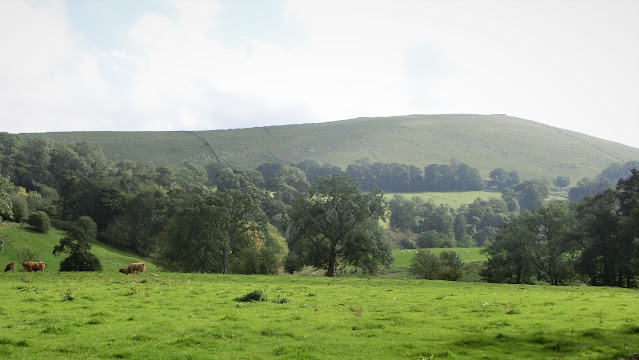
Only a couple of days since our last jaunt on this project but, with more coronavirus restrictions looking imminent, we thought we'd better get a move on! Joined by daughter, Kirstie, & Jamie's Eeyore again on a fine, sunny if windy day!
Bit concerned that we might struggle to park at Hulme End as we hadn't realised today was Rubie's Walk day, an annual charity event along the Manifold Trail to raise money for meningitis. Fortunately, things were underway by the time we arrived, the walkers had set off & so it wasn't too busy!
Supposed to be Day 3 of the Northern leg but we set off in a south-easterly direction... just to take in the views!
All geared-up for today's socially-distanced adventure... pity it doesn't do anything for the focus!
Started off from the terminus of The Leek & Manifold Railway at Hulme End, the narrow-gauge line that we'd followed from Waterhouses. Both these photos were taken outside the Visitor Centre, formerly the ticket office!
Inside is this fine model of Hulme End station as it looked in 1934 when it was finally closed. The engine-shed in the foreground has been rebuilt & now houses 'The Tea Junction' cafe/restaurant.
Wolfscote Hill
There are at least half a dozen camping and/or caravanning sites in the area immediately around Hulme End but, after about a mile, civilization is left behind as a narrow cul-de-sac wends its way towards Beresford Dale, the River Dove & Wolfscote Hill.
The remains of a Neolithic Bowl Barrow can be picked out on top of the hill which, when excavated in the 1840s, was found to contain 2 child skeletons & a food vessel.
Crossing the River Dove & a thoughtful invitation on an enormous tree stump!
Frank i' th' Rocks cave at the Northern end of Wolfscote Dale
Its name can be found on the bridge over the Dove, just below the outcrop.
Here, too, was a Neolithic burial chamber, just around to the right in the first photo and not in the cave that Kirstie is sitting in!
Wolfscote Dale
Took a brief detour along Wolfscote Dale to discover a geocache high up the side of the gorge. This is the view southwards from the cache, along the Dove!
... &, only to be fair, this is the view northwards from the cache back to Beresford Dale!
Heathcote Mere
An unusual feature in this part of the Peak District - water that stays where it's put & doesn't go diving off through the limestone! That's because there's a layer of volcanic rock above the porous limestone here which has made the Mere an important watering-hole for centuries!
On a major packhorse route from East to West, fines were introduced as early as 1745 for anyone found to be polluting the water.
Hartington Station
We joined 'The Tissington Trail' at Heathcote, just along the lane from the Mere, & headed along the old railway route to Hartington Station... albeit 2 miles from the village!
Closed to regular passengers in 1954, its final closure came in 1963 when the buildings were demolished... apart from this wonderful Signal Box which was preserved as a Visitor Centre, still selling hot snacks & ice-creams despite the Covid-cones & warning signs!
Stopped for cider & ice-creams here - I'll let you guess who opted for what!
Majestic cutting on 'The Tissington Trail' just south of where the old Ashbourne to Buxton line meets the High Peak Trail.
And this is the point where the two old lines met... or parted company depending upon your direction of travel!
The line between Ashbourne & Buxton opened in 1899 & at its height of importance carried express trains between Manchester & London. Like 'The Leek & Manifold', its milk-trains were also essential running a daily service to London throughout World War 11.
It finally became a walking & cycle route in 1971, over 40 years after 'The Manifold Way'.
The High Peak Trail is older & much more famous!
It opened in 1831 & carried the Cromford & High Peak Railway from Cromford Canal to the Peak Forest Canal at Whaley Bridge, a distance of 33 miles. It climbed from 277feet above sea level to over 1000 feet at Ladmanlow before falling back to 517 feet at its terminus!
This was a Goods' line, though, carrying mainly corn, minerals & coal : it finally closed in 1967.
One last photo on the last bridge before Parsley Hay, a bike-hire centre so quite busy... but overall it was a gentle day!
Today's distance : 7.70 miles 12.40 kilometres
Cumulative : 24.85 miles 40.00 kilometres
Direction of Travel : North-East
Progress : We are now 382.03 miles from John o' Groats (-2.42 miles)!
& 273.26 miles from Land's End (+3.90 miles)!


Well, you forgot to mention that we have to choose our start and finish points by the parking payment facilities! In these days of covid no cash, we can't afford to park in places that only take coins!
ReplyDelete